Bangladesh: Land, People and History · Chapter 14 of 16
Bangladesh Map: The 64 Districts and 8 Divisions
Bangladesh is divided into 8 divisions and 64 districts (zila), and the number of districts has stayed at 64 at every census since 1991.1 The Population and Housing Census 2022 counted 165,158,616 people, a figure the Bangladesh Bureau of Statistics (BBS) adjusts to 169,828,911 to allow for people the count missed.2 On the BBS area of 147,570 sq km that is 1,119 people per sq km, but the districts range from 106 per sq km in Rangamati to 10,067 in Dhaka.3
- 64
- Districts, grouped in 8 divisions, at the 2022 census4
- 165,158,616
- People counted (the enumerated population) in June 20225
- 169,828,911
- Adjusted population, after a check that put the net undercount at 2.75%6
- 10,067
- People per sq km in Dhaka district, the densest; Rangamati has 1067
- 74.80%
- Literacy of people aged 7 and over, up from 51.77% in 20118
- 2 April 2018
- Chittagong, Comilla, Barisal, Jessore and Bogra get new English spellings9
Sources: Bangladesh Bureau of Statistics, Population and Housing Census 2022; bdnews24; Prothom Alo.10
Columns show population (people, 2022). Highest: Dhaka (14,734,701), Chattogram (9,169,465), Cumilla (6,212,216).
- Dhaka
- Chattogram
- Rajshahi
- Khulna
- Barishal
- Sylhet
- Rangpur
- Mymensingh
All 64 districts in a table
| District | Division | Population, 2022 | Area (km²) | People per km² | Literacy (%) |
|---|---|---|---|---|---|
| Bagerhat বাগেরহাট | Khulna | 1,613,076 | 3,959.1 | 407 | 81.42 |
| Bandarban বান্দরবান | Chattogram | 481,106 | 4,479 | 107 | 63.74 |
| Barguna বরগুনা | Barishal | 1,010,531 | 1,831.3 | 552 | 80.65 |
| Barishal বরিশাল | Barishal | 2,570,446 | 2,784.5 | 923 | 79.85 |
| Bhola ভোলা | Barishal | 1,932,518 | 3,403.5 | 568 | 67.30 |
| Bogura বগুড়া | Rajshahi | 3,734,297 | 2,898.7 | 1,288 | 72.55 |
| Brahmanbaria ব্রাহ্মণবাড়িয়া | Chattogram | 3,306,563 | 1,881.2 | 1,758 | 72.12 |
| Chandpur চাঁদপুর | Chattogram | 2,635,748 | 1,645.3 | 1,602 | 78.23 |
| Chapainawabganj চাঁপাইনবাবগঞ্জ | Rajshahi | 1,835,528 | 1,702.5 | 1,078 | 72.00 |
| Chattogram চট্টগ্রাম | Chattogram | 9,169,465 | 5,282.9 | 1,736 | 81.06 |
| Chuadanga চুয়াডাঙ্গা | Khulna | 1,234,054 | 1,174.1 | 1,051 | 71.20 |
| Cox's Bazar কক্সবাজার | Chattogram | 2,823,268 | 2,491.9 | 1,133 | 71.58 |
| Cumilla কুমিল্লা | Chattogram | 6,212,216 | 3,146.3 | 1,974 | 76.68 |
| Dhaka ঢাকা | Dhaka | 14,734,701 | 1,463.6 | 10,067 | 84.88 |
| Dinajpur দিনাজপুর | Rangpur | 3,315,236 | 3,444.3 | 963 | 76.14 |
| Faridpur ফরিদপুর | Dhaka | 2,162,879 | 2,052.9 | 1,054 | 72.13 |
| Feni ফেনী | Chattogram | 1,648,896 | 990.4 | 1,665 | 80.79 |
| Gaibandha গাইবান্ধা | Rangpur | 2,562,233 | 2,114.8 | 1,212 | 67.00 |
| Gazipur গাজীপুর | Dhaka | 5,263,450 | 1,806.4 | 2,914 | 81.42 |
| Gopalganj গোপালগঞ্জ | Dhaka | 1,295,057 | 1,468.7 | 882 | 79.84 |
| Habiganj হবিগঞ্জ | Sylhet | 2,358,886 | 2,636.6 | 895 | 69.44 |
| Jamalpur জামালপুর | Mymensingh | 2,499,738 | 2,115.2 | 1,182 | 61.70 |
| Jashore যশোর | Khulna | 3,076,144 | 2,606.9 | 1,180 | 77.07 |
| Jhalokati ঝালকাঠি | Barishal | 661,160 | 706.8 | 935 | 83.21 |
| Jhenaidah ঝিনাইদহ | Khulna | 2,005,849 | 1,964.8 | 1,021 | 72.81 |
| Joypurhat জয়পুরহাট | Rajshahi | 956,431 | 1,012.4 | 945 | 73.73 |
| Khagrachhari খাগড়াছড়ি | Chattogram | 714,119 | 2,749.2 | 260 | 71.80 |
| Khulna খুলনা | Khulna | 2,613,385 | 4,394.4 | 595 | 80.66 |
| Kishoreganj কিশোরগঞ্জ | Dhaka | 3,267,626 | 2,688.6 | 1,215 | 67.60 |
| Kurigram কুড়িগ্রাম | Rangpur | 2,329,160 | 2,245 | 1,037 | 65.13 |
| Kushtia কুষ্টিয়া | Khulna | 2,149,692 | 1,608.8 | 1,336 | 69.01 |
| Lakshmipur লক্ষ্মীপুর | Chattogram | 1,937,948 | 1,440.4 | 1,345 | 73.98 |
| Lalmonirhat লালমনিরহাট | Rangpur | 1,428,406 | 1,247.4 | 1,145 | 71.30 |
| Madaripur মাদারীপুর | Dhaka | 1,293,027 | 1,125.7 | 1,149 | 74.93 |
| Magura মাগুরা | Khulna | 1,033,115 | 1,039.1 | 994 | 72.21 |
| Manikganj মানিকগঞ্জ | Dhaka | 1,558,025 | 1,383.7 | 1,126 | 71.17 |
| Meherpur মেহেরপুর | Khulna | 705,356 | 751.6 | 951 | 68.14 |
| Moulvibazar মৌলভীবাজার | Sylhet | 2,123,447 | 2,799.4 | 759 | 75.85 |
| Munshiganj মুন্সীগঞ্জ | Dhaka | 1,625,416 | 1,004.3 | 1,618 | 77.90 |
| Mymensingh ময়মনসিংহ | Mymensingh | 5,899,005 | 4,394.6 | 1,342 | 70.89 |
| Naogaon নওগাঁ | Rajshahi | 2,784,599 | 3,435.6 | 811 | 72.24 |
| Narail নড়াইল | Khulna | 788,671 | 968 | 815 | 74.66 |
| Narayanganj নারায়ণগঞ্জ | Dhaka | 3,909,138 | 684.4 | 5,712 | 79.24 |
| Narsingdi নরসিংদী | Dhaka | 2,584,452 | 1,150.1 | 2,247 | 74.81 |
| Natore নাটোর | Rajshahi | 1,859,922 | 1,900.2 | 979 | 71.51 |
| Netrokona নেত্রকোণা | Mymensingh | 2,324,853 | 2,794.3 | 832 | 66.25 |
| Nilphamari নীলফামারী | Rangpur | 2,092,568 | 1,546.6 | 1,353 | 69.23 |
| Noakhali নোয়াখালী | Chattogram | 3,625,442 | 3,685.9 | 984 | 75.52 |
| Pabna পাবনা | Rajshahi | 2,909,624 | 2,376.1 | 1,225 | 70.49 |
| Panchagarh পঞ্চগড় | Rangpur | 1,179,843 | 1,404.6 | 840 | 73.66 |
| Patuakhali পটুয়াখালী | Barishal | 1,727,254 | 3,221.3 | 536 | 76.70 |
| Pirojpur পিরোজপুর | Barishal | 1,198,195 | 1,277.8 | 938 | 85.53 |
| Rajbari রাজবাড়ী | Dhaka | 1,189,818 | 1,092.3 | 1,089 | 69.49 |
| Rajshahi রাজশাহী | Rajshahi | 2,915,009 | 2,425.4 | 1,202 | 75.17 |
| Rangamati রাঙ্গামাটি | Chattogram | 647,586 | 6,116.1 | 106 | 71.41 |
| Rangpur রংপুর | Rangpur | 3,169,614 | 2,400.6 | 1,320 | 70.73 |
| Satkhira সাতক্ষীরা | Khulna | 2,196,582 | 3,817.3 | 574 | 75.32 |
| Shariatpur শরীয়তপুর | Dhaka | 1,294,562 | 1,174.1 | 1,103 | 72.90 |
| Sherpur শেরপুর | Mymensingh | 1,501,853 | 1,364.7 | 1,101 | 63.70 |
| Sirajganj সিরাজগঞ্জ | Rajshahi | 3,357,706 | 2,402.1 | 1,398 | 69.48 |
| Sunamganj সুনামগঞ্জ | Sylhet | 2,695,496 | 3,747.2 | 719 | 64.92 |
| Sylhet সিলেট | Sylhet | 3,857,123 | 3,452.1 | 1,117 | 76.43 |
| Tangail টাঙ্গাইল | Dhaka | 4,037,608 | 3,414.3 | 1,183 | 69.75 |
| Thakurgaon ঠাকুরগাঁও | Rangpur | 1,533,895 | 1,781.7 | 861 | 74.38 |
| Total | 165,158,616 |
Sources: Population and density: 11. Literacy: 12. Area: 13. District outlines: geoBoundaries (Runfola et al. 2020), from the Bangladesh Bureau of Statistics and OCHA ROAP, CC BY 3.0 IGO, simplified.
Census night, 14 June 2022
At midnight on 14 June 2022, census staff across Bangladesh began counting the people with no home to be counted in. Until 6 a.m. on 15 June they recorded the floating population, and from 15 to 21 June they counted everyone else.14 They entered the answers on tablets: BBS calls it the first digital census in the country's history, and the sixth since independence.15 It had been due in 2021 and was put back because of COVID-19.16 Then a flash flood hit the north-east, and in four flood-affected districts the count ran on until 28 June.17
The result is the map at the top of this page: 64 districts, each with a population, an area, a density and a literacy rate. It looks permanent. It is not, and that is the thread of this chapter. At the 1981 census Bangladesh had 21 districts; ten years later it had 64.18 Most of today's districts were sub-divisions until they were raised to district status in 1983 and 1984, and five of them changed their English names as recently as 2018.19 The figures need the same care as the borders. District populations are raw counts, not the adjusted totals usually quoted for the country, and the areas behind the densities come from a different BBS publication.20
Read with those cautions, the census shows how unevenly the people of Bangladesh are spread. Dhaka district alone holds 14,734,701 people, 8.9 per cent of everyone counted, on 1,463.6 sq km.21 Bandarban, in the hills of the south-east, holds 481,106 on 4,479 sq km.22 Most of what follows, division by division, is about the places in between.
How to read the Bangladesh map
The map gives each district's enumerated population: the number of people the census actually counted. That matters because the 2022 census produced two national totals.23 After the count, the Bangladesh Institute of Development Studies carried out a Post Enumeration Check and put the net coverage error, or net undercount, at 2.75 per cent; BBS calls this the lowest in the history of the census, against 3.97 per cent in 2011.24 Dividing the enumerated total by one minus that error gives the adjusted population: 169,828,911 instead of 165,158,616.25
BBS publishes adjusted figures only for the country, the divisions, urban and rural areas, sex, religion and age group, never for districts.26 So the 64 district figures are all enumerated counts, and they add up exactly to 165,158,616.27 The adjusted figures for the 8 divisions add up exactly to 169,828,911.28 The two series should not be mixed: a district's count set against the adjusted national total will always look a little too small.
Density is shown as BBS prints it, in persons per sq km.29 Area is harder. Volume I of the census report has no district area column, so the areas on the map come from Table 2.02 of the BBS Statistical Yearbook Bangladesh 2023.30 Despite its heading, "Administrative Units by District, 2011", that table's areas reproduce the printed 2022 densities, to within rounding, for 62 of the 64 districts.31 Older references, Banglapedia among them, still give earlier areas, which no longer reproduce the 2022 densities for twelve districts; Barguna, for example, goes from 1,509.42 sq km in Banglapedia to 1,831.3 in the yearbook.32
Two districts do not match at all. Meherpur's population divided by its printed density implies about 742 sq km, but the yearbook gives 751.6; Satkhira's implies about 3,827 sq km, but the yearbook gives 3,817.3.33 The map shows the yearbook area and the printed density for both, so for these two districts the figures do not quite multiply back to the population. The separate district census reports may hold the exact 2022 areas; they were not consulted for this chapter. One more small trap: the yearbook prints Jashore's area as "2606..9", read here as 2,606.9 sq km.34
Literacy is the share of people aged 7 and over who can read and write. BBS's definition is simple: "A person who can read and write at least in one language is treated as literate."35 Nationally the rate was 74.80 per cent in 2022, 76.71 per cent for men and 72.94 per cent for women, 71.68 per cent in rural areas and 81.45 per cent in urban ones.36
Anyone comparing these figures with older articles should know that the preliminary report, published on 27 July 2022, gave the same national total but differs from the final report in 54 of its 73 rows for the country, divisions and districts.37 Most rows moved by a handful of people. The largest district changes were in Jashore (705 fewer in the final count), Dhaka (676 more), Noakhali (190 more) and Lakshmipur (163 fewer).38 This chapter uses the final figures throughout. The final table also misspells Kishoreganj as "Kishoregonj", while the same report's literacy table spells it correctly.39
The district outlines on the map come from geoBoundaries, which repackages an older BBS and OCHA release and still uses the pre-2018 names, such as Chittagong and Comilla, in its data.40 For anyone making their own map, the Common Operational Dataset published by OCHA on the Humanitarian Data Exchange is closer to the source: it uses the current official spellings, carries BBS-style P-codes (Dhaka is BD3026, Narayanganj BD3067) and is licensed CC BY-IGO 3.0.41 It still spells two names differently from BBS, "Chapainababganj" and "Netrakona", so a join to the census table needs those two aliases.42
What are the 8 divisions of Bangladesh?
Bangladesh's 8 divisions are Barishal, Chattogram, Dhaka, Khulna, Mymensingh, Rajshahi, Rangpur and Sylhet, each named after the city that serves as its administrative capital.43 The number has grown at almost every census: 4 in 1974 and 1981, 5 in 1991, 6 in 2001, 7 in 2011 and 8 in 2022.44 Banglapedia dates the division of Barishal (then spelt Barisal) to 1 January 1993, Sylhet to 1 August 1995 and Rangpur to 25 January 2010.45 The census count of 5 divisions in 1991 therefore sits awkwardly with Barishal's date two years later; the sources used here do not explain the gap. The map may not stay at eight: the UK Permanent Committee on Geographical Names reported in July 2023 that two more divisions, Meghna and Padma, were approved in 2022 but that their creation had been delayed.46 The 2022 census and the current OCHA boundary data both still have 8 divisions.47
Dhaka is by far the largest division by population, with 45,644,586 people after adjustment, 26.88 per cent of the national total; Barishal is the smallest, with 9,325,820, or 5.49 per cent.48 Dhaka also has the highest literacy of the eight, 78.24 per cent, and Mymensingh the lowest, 67.23 per cent.49
| Division | Bangla | Older spelling | Districts | Population (enumerated) | Population (adjusted) | Households | Area (sq km) | Density (per sq km) | Literacy 7+ (%) | Became a division |
|---|---|---|---|---|---|---|---|---|---|---|
| Barishal | বরিশাল | Barisal | 6 | 9,100,104 | 9,325,820 | 2,219,707 | 13,225.2 | 688 | 77.74 | 1 January 199350 |
| Chattogram | চট্টগ্রাম | Chittagong | 11 | 33,202,357 | 34,178,612 | 7,528,141 | 33,908.6 | 979 | 76.70 | Before 1971 (date not researched) |
| Dhaka | ঢাকা | 13 | 44,215,759 | 45,644,586 | 11,627,601 | 20,509.1 | 2,156 | 78.24 | Before 1971 (date not researched) | |
| Khulna | খুলনা | 10 | 17,415,924 | 17,813,218 | 4,500,969 | 22,284.1 | 781 | 75.13 | Before 1971 (date not researched) | |
| Mymensingh | ময়মনসিংহ | 4 | 12,225,449 | 12,637,472 | 3,057,543 | 10,668.8 | 1,146 | 67.23 | Approved 14 September 2015; gazetted 13 October 201551 | |
| Rajshahi | রাজশাহী | 8 | 20,353,116 | 20,794,019 | 5,371,658 | 18,153.0 | 1,121 | 72.01 | Before 1971 (date not researched) | |
| Rangpur | রংপুর | 8 | 17,610,955 | 18,020,071 | 4,488,954 | 16,185.0 | 1,088 | 70.86 | 25 January 201052 | |
| Sylhet | সিলেট | 4 | 11,034,952 | 11,415,113 | 2,213,644 | 12,635.3 | 873 | 72.06 | 1 August 199553 | |
| Bangladesh | বাংলাদেশ | 64 | 165,158,616 | 169,828,911 | 41,008,217 | 147,570 | 1,119 | 74.80 |
Source: Enumerated population, households and density: 54. Adjusted population: 55. Literacy of people aged 7 and over: 56. Division areas are the sums of the district areas in 57; the national area is the official BBS figure, 0.9 sq km more than the sum of the districts because the yearbook rounds each area to one decimal place.58 Bangla names: Banglapedia's division articles and the 2015 gazette.59
Show the numbers
| Year | Enumerated | Adjusted |
|---|---|---|
| Dhaka | 44.22 | 45.64 |
| Chattogram | 33.2 | 34.18 |
| Rajshahi | 20.35 | 20.79 |
| Rangpur | 17.61 | 18.02 |
| Khulna | 17.42 | 17.81 |
| Mymensingh | 12.23 | 12.64 |
| Sylhet | 11.03 | 11.42 |
| Barishal | 9.1 | 9.33 |
Source: Bangladesh Bureau of Statistics, rounded to the nearest 10,000 from the exact figures in the table above.60 Download CSV
Dhaka Division districts
Dhaka Division has 13 districts and 44,215,759 people by the 2022 count, and at 2,156 per sq km it is the most crowded division by a wide margin.61 It also holds the four densest districts in the country: Dhaka, Narayanganj, Gazipur and Narsingdi.62
Dhaka district contains the national capital, which became a municipality in 1864 and a city corporation in 1990.63 The city is now run as two corporations, Dhaka North with 5,990,723 people in 2022 and Dhaka South with 4,305,063.64 The district's 14,734,701 people make it the most populous in Bangladesh, and its density of 10,067 per sq km is the highest; its literacy rate, 84.88 per cent, is second only to Pirojpur's.65
Narayanganj, on the Shitalakshya, is the smallest district by area, 684.4 sq km, yet with 3,909,138 people it is the second densest, at 5,712 per sq km.66 Inside it lies Sonargaon, the capital of the earliest independent sultanate of Bengal, founded by Fakhruddin Mubarak Shah, from 1338; Panam Nagar and the Folk Art and Crafts Foundation are there too.67 The sultanate's story is told in the chapter on the Bengal Sultanate. Gazipur, the third densest district at 2,914 per sq km, has 5,263,450 people, and its city corporation alone counted 2,677,715.68 It is known for Bhawal National Park, the Bhawal Rajbari and the Tongi bridge of Mir Jumla.69
Narsingdi, fourth in density at 2,247 per sq km, is the home of Wari-Bateshwar, an archaeological site that has yielded beads of semi-precious stone and glass and silver punch-marked coins.70 The site belongs to the period covered in Ancient Bengal. Tangail, with 4,037,608 people, is known for its handloom saris and for Madhupur National Park, and the Bangabandhu Jamuna Multipurpose Bridge, opened in June 1998, stands in its Bhuapur and Kalihati area.71 Kishoreganj is haor (wetland) country and the home of the Mymensingha Gitika folk ballads and the Sholakia Eid congregation.72
South and west of the capital lie the Padma districts. Faridpur, a district since 1815, has the house of the poet Jasimuddin and the Pathrail mosque.73 Rajbari, a district from March 1984, holds the Goalanda ferry ghat on the Padma and the tomb of the writer Mir Mosharraf Hossain.74 Shariatpur, on the Padma and the Meghna, became a district on 1 March 1984 and has the Fateh Jangapur Fort at Naria.75 Madaripur sits on the Arial Khan and Kumar rivers, with the Charmuguria river port and the dargah of Shah Madar.76 Gopalganj contains Tungipara, the site of the memorial complex to Sheikh Mujibur Rahman that Banglapedia calls the Bangabandhu Memorial Complex.77
Closer to Dhaka, Manikganj lies on the Padma, the Jamuna and the Dhaleshwari, and was a sub-division from 1845.78 Munshiganj has the fort at Idrakpur and the remains at Rampal, including Ballal Sena's dighi (tank) and Baba Adam's mosque.79
Chattogram Division districts
Chattogram Division has 11 districts and 33,202,357 people, and it is the division of extremes.80 It holds the second and third most populous districts in the country, Chattogram and Cumilla, and also the three least dense, the hill districts of Rangamati, Bandarban and Khagrachhari.81
Chattogram district, 9,169,465 people on 5,282.9 sq km, is the second largest district by both population and area.82 It was established as a district in 1666, and its city corporation counted 3,230,507 people in 2022.83 Chittagong Port, on the Karnafuli estuary, is "the principal sea port of Bangladesh", and the country's first export processing zone was set up in Chittagong in 1983.84 Cumilla, with 6,212,216 people and 1,974 per sq km, is the third most populous district and the fifth densest.85 It is known for the Mainamati-Lalmai ridge, with the Buddhist monastery of Shalban Vihara and the Mainamati Museum.86
Around Cumilla, the Meghna districts run down to the sea. Brahmanbaria, on the Meghna and Titas rivers, was part of Comilla (Tripura) district until 1984.87 It is one of four districts where women's literacy is higher than men's: 72.44 against 71.74 per cent.88 Chandpur, on the Meghna, Dakatia and Gumti rivers, has a District Illish Chattor, a hilsa square.89 Lakshmipur became a sub-division in 1979 and a district in 1984, and has the Sreerampur Rajbari; women's literacy there is also slightly higher than men's, 74.08 against 73.87 per cent.90 Noakhali was set up in 1821 as Bhulua district and renamed in 1868.91 Its coast on the Meghna estuary includes Hatiya island, and at Jayag in Begumganj upazila is the Gandhi Ashram, working since 1946; Gandhi reached Chaumohani on a peace mission on 7 November that year.92 Feni, a district since 1984, lies on the Feni and Muhuri rivers along the border with Tripura.93
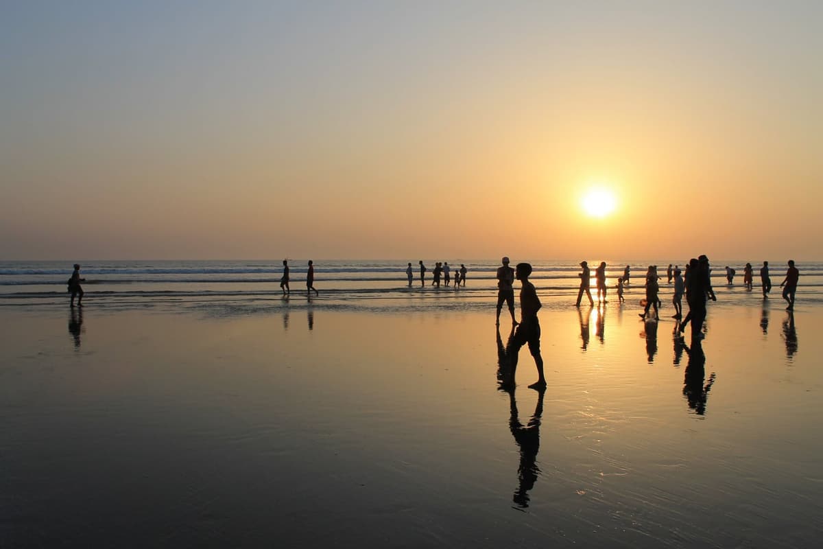
Cox's Bazar, a district since 1 March 1984, is known for its sea beach and for two islands, St Martin's and Maheshkhali.94 Its 2,823,268 people live at 1,133 per sq km.95
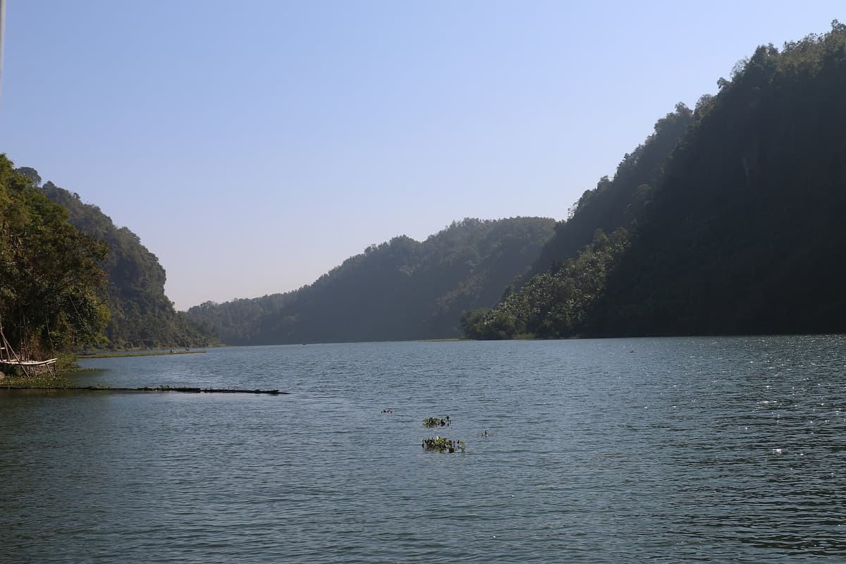
The three hill districts share one history. In 1860 the Chittagong Hill Tracts district was carved out of Chittagong district, and in 1900 it was divided into three sub-divisions, which later became Rangamati, Khagrachhari and Bandarban.97 Bandarban became a district on 1 October 1981, Rangamati and Khagrachhari in 1983.98 Rangamati is the largest district in Bangladesh, 6,116.1 sq km, and the least densely peopled, at 106 per sq km.99 It holds Kaptai Lake, "the largest man-made freshwater body in Bangladesh", made by damming the Karnafuli near Kaptai, and the Chakma Rajbari.100 Khagrachhari is home to Chakma, Marma and Tripura communities.101 Bandarban, with 481,106 people, is the least populous district in the country, and its literacy rate, 63.74 per cent, is among the three lowest.102 It contains the peak of Keokradong, whose height is disputed (see below).103
Rajshahi Division districts
Rajshahi Division has 8 districts and 20,353,116 people, at 1,121 per sq km.105 Its northern districts hold two major archaeological sites, Mahasthangarh in Bogura and Paharpur in Naogaon.106
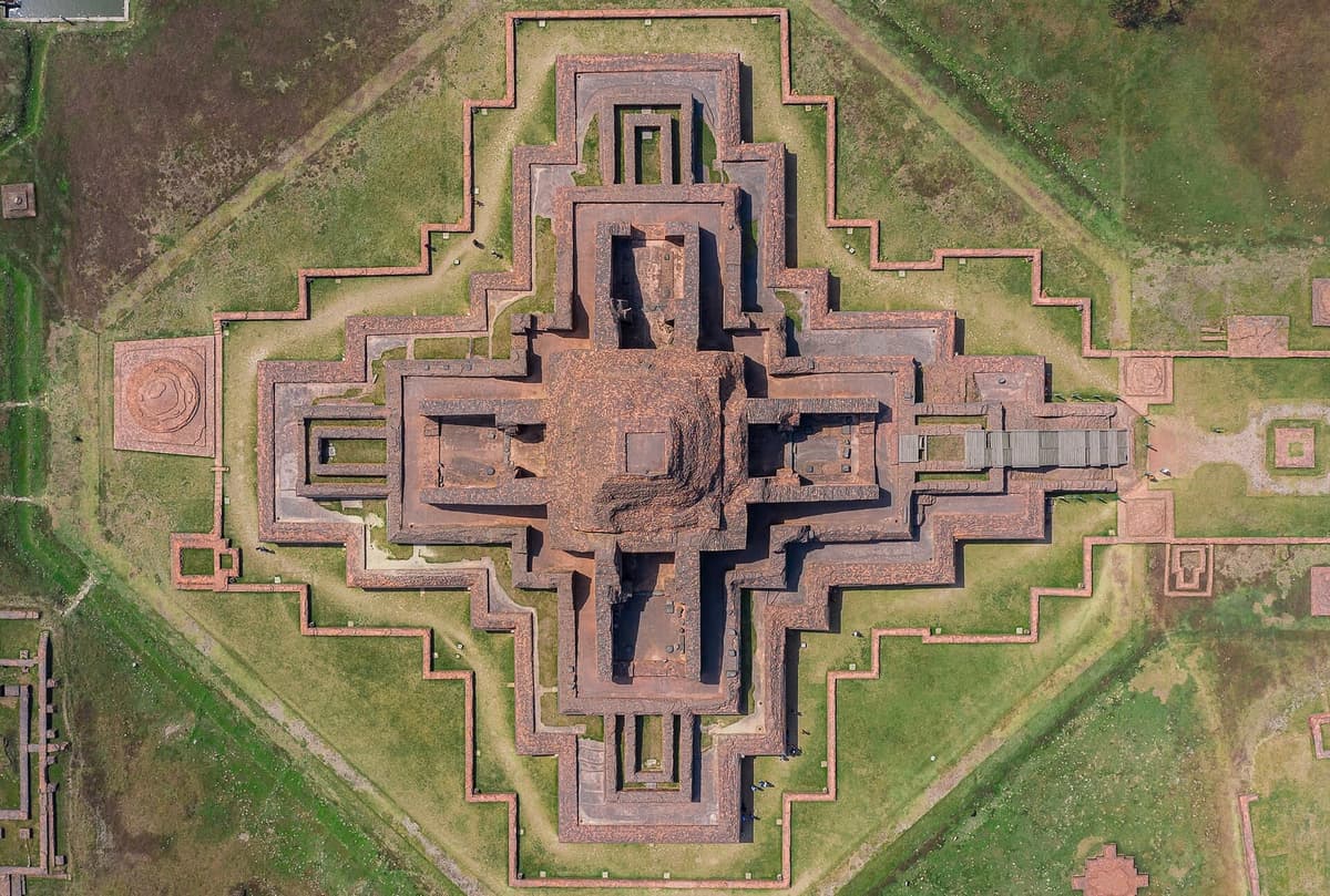
Bogura, a district since 1821, has 3,734,297 people.107 About 13 km north of the town lies Mahasthan, or Mahasthangarh, the ruins of ancient Pundranagara, which Banglapedia calls "the earliest and the largest archaeological site in Bangladesh".108 Joypurhat, a sub-division of Bogra until 1984, is home to Santal, Munda and Oraon communities.109 Naogaon contains Paharpur, in Badalgachhi upazila, the site of the Buddhist monastery of Somapura Mahavihara, which Banglapedia records as declared a World Heritage Site in 1985.110 The monastery's history is told in Kingdoms of Bengal.
Rajshahi, a district since 1772, lies on the Padma (the Ganges) in the Barind tract and is known for the Varendra Research Museum; its city corporation counted 553,288 people.112 Chapainawabganj, west of it, has the Chhota Sona Mosque, which stands in the Firuzpur quarter of the old sultanate capital of Gaur-Lakhnauti and is listed among the heritage of Shibganj upazila; Shibganj's main exports include mangoes and silk saris.113 It has the widest lead of women over men in literacy of any district, 73.05 against 70.85 per cent.114 Banglapedia still files it under its older name, Nawabganj District.115
Natore has the Rajbari of Rani Bhabani and the Dighapatia Rajbari, now the Uttara Ganabhaban.116 It shares Chalan Beel with Rajshahi, Pabna and Sirajganj: Banglapedia calls it "the largest beel of the country", covering about 368 sq km in the rainy season.117 Pabna, a district since 1832, has the railway junction at Ishwardi and the Rooppur nuclear power site, and the Hardinge Bridge, which crosses the lower Ganges at Sara, between Paksey and Bheramara stations; its construction was sanctioned in 1908.118 Sirajganj, with 3,357,706 people, has the Bangabandhu Jamuna Multipurpose Bridge, opened in June 1998, and part of Chalan Beel.119
Rangpur Division districts
Rangpur Division, the far north-west, became a division on 25 January 2010.120 It has 8 districts and 17,610,955 people, at 1,088 per sq km.121 On 1 August 2015 India and Bangladesh exchanged 162 enclaves, 111 of them lying in Bangladesh and 51 in India, and the division's northern districts still carry the traces.122
Rangpur district has 3,169,614 people, and its city corporation 708,570.123 Roquiah Sakhawat Hossain, known as Begum Rokeya, was born at Pairaband in Rangpur on 9 December 1880, and the Tajhat Zamindar Bari is one of the district's landmarks.124 Dinajpur, a district since 1786 and formerly Ghoraghat district, has 3,315,236 people.125 About 12 miles north of the town stands Kantanagar Temple, an eighteenth-century nine-spired (nava-ratna) temple known for its terracotta decoration, which lost its spires in the earthquake of 1897.126 About 8 km south of the town is Ramsagar, which "is considered to be the biggest man-made tank of Bangladesh".127
Three districts follow the big rivers. Gaibandha, on the Brahmaputra-Jamuna, was formerly the Bhabaniganj sub-division (1858) and is remembered for the Tebhaga movement of 1946.128 Kurigram, on the Brahmaputra, Dharla and Dudhkumar, borders both West Bengal and Assam; its literacy rate is 65.13 per cent.129 Lalmonirhat has the Dahagram and Angarpota enclaves, joined to the mainland by the Tin Bigha Corridor, and the Tista Railway Bridge.130
Nilphamari is known for the Uttara Export Processing Zone and the Nilsagar dighi.131 Banglapedia puts the Tista Barrage in two places: in Dimla upazila of Nilphamari in its Nilphamari article, and at Doani in Hatibandha upazila of Lalmonirhat in its Rangpur Division article; the barrage spans the river between the two districts.132 In the far north, Panchagarh has Tentulia and the Banglabandha Zero Point, tea gardens and former Indian enclaves.133 Thakurgaon has the sal forests of Saguni and Thumnia and the Jagadal Zamindar Bari.134
Khulna Division districts
Khulna Division, in the south-west, has 10 districts and 17,415,924 people, at 781 per sq km.135 Its southern edge is the Sundarbans, the mangrove forest that covers the southern parts of Satkhira, Khulna and Bagerhat districts.136 Banglapedia lists the Sundarbans among Bangladesh's World Heritage Sites.137
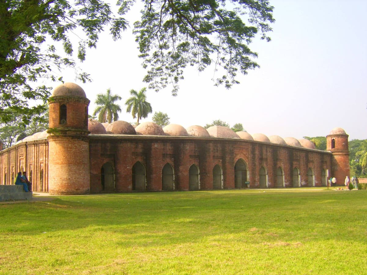
Khulna, a district since 1882, is the divisional city on the Rupsa and home to the Khulna Shipyard; its city corporation counted 719,557 people.138 Bagerhat is the site of the Mosque City of Bagerhat, a World Heritage Site.139 Its Shatgumbad Mosque is "the largest of the Sultanate mosques in Bangladesh", attributed to Khan Jahan, who ruled from Haveli-Khalifatabad, present-day Bagerhat, until his death in 1459.140 Bagerhat, part of which lies in the Sundarbans, has only 407 people per sq km.141 Satkhira is the south-western extremity of Bangladesh.142
North of the forest, the division's history is one of poets and political firsts. Jashore, a district since 1781, has Sagardari, where the poet Michael Madhusudan Dutt was born on 25 January 1824; the village is known as Madhu Palli.144 In Narail, whose town stands on the Chitra river, the painter SM Sultan was born, at Masimdia, on 10 August 1923.145 Magura, on the Gorai-Madhumati and Nabaganga rivers, became a district on 1 March 1984.146
Kushtia was formed in 1947 from the Kushtia Sadar, Chuadanga and Meherpur sub-divisions of Nadia.147 It holds the tomb of Lalon Shah (1774 to 1890), Tagore's Kuthibari at Shilaidaha, and the Hardinge Bridge at Bheramara.148 Where Lalon was born is disputed: Banglapedia gives Harishpur in Jhenaidah district, and "variantly" Bhadra in Kumarkhali, Kushtia.149 Jhenaidah also has the six-domed Sultanate mosque at Shailkupa, of about 1520.150 Chuadanga, a former Nadia sub-division, is known for its history in the Indigo Rebellion of 1859 to 1860 and for the Gholdari mosque.151 That rebellion is part of the story of Colonial Bengal.
Meherpur, a district since 24 February 1984, has only 705,356 people and 751.6 sq km, but a central place in the country's history.152 On 17 April 1971 the first government of Bangladesh took its oath at Baidyanathtala, in what was then Meherpur sub-division, and the place was renamed Mujibnagar.153 The Liberation War chapter tells that story.
Mymensingh Division districts
Mymensingh is the newest division. On 14 September 2015 the National Implementation Committee for Administrative Reform approved it, made up of Sherpur, Jamalpur, Mymensingh and Netrokona districts; Cabinet Secretary Musharraf Hossain Bhuiyan announced the decision, and Tangail and Kishoreganj stayed in Dhaka Division.154 A Ministry of Public Administration notification on its creation, S.R.O. No. 304-Law/2015, is dated 13 October 2015.155 The division has 12,225,449 people and the lowest literacy rate of the eight, 67.23 per cent.156
Mymensingh, a district since 1787, has 5,899,005 people, the fourth largest population of any district, and its city corporation counted 577,000.157 It is the home of Bangladesh Agricultural University, established in 1961 under the East Pakistan Agricultural University Ordinance of that year (Banglapedia's district article gives 1960), and of the Mymensingha Gitika folk ballads.158 At 4,394.6 sq km it is the fourth largest district by area, but only just: the yearbook puts Khulna at 4,394.4 sq km, 0.2 sq km behind, and both figures are rounded to one decimal place.159
Jamalpur, a district since 1978, lies on the Jamuna and is known for the fakir-sannyasi resistance of 1772 to 1790 and its Garo community.160 Its literacy rate, 61.70 per cent, is the lowest of any district.161 Sherpur, with 63.70 per cent, is second lowest; it reaches the hills of the Meghalaya border, with the Madhutila Ecopark and the Gazni Recreation Centre.162 Netrokona, also on the Meghalaya border, is home to Garo and Hajong communities and to the Birisiri Tribal Cultural Academy at Durgapur.163 Its name is also spelt Netrakona, as in The Daily Star in 2015; BBS and Banglapedia use Netrokona.164
Sylhet Division districts
Sylhet Division, in the north-east, became a division on 1 August 1995; Banglapedia's Sylhet district article calls it "the 6th division of the country".165 It has 4 districts and 11,034,952 people, at 873 per sq km.166 It is the country's tea and haor (wetland) country.167
Sylhet district, established on 3 January 1782, has 3,857,123 people, and its city corporation 532,839.168 The Sufi saint Shah Jalal "lies buried at Sylhet".169 Tea came in the nineteenth century: the industry developed, in Banglapedia's words, "in Assam and especially in Sylhet", with British planting on its hill slopes.170 Moulvibazar has tea estates and the Bangladesh Tea Research Institute, Lawachhara National Park and the Madhabkunda waterfall.171 Habiganj has tea gardens, Teliapara among them, and the Bibiana gas field.172
Sunamganj is haor country. Tanguar Haor lies in its Dharmapasha and Tahirpur upazilas, and the mystic composer Hasan Raja (1854 to 1922) was born at Lakshmansree, in what was then Sunamganj subdivision.173 Its literacy rate is 64.92 per cent.174
Barishal Division districts
Barishal Division, on the delta coast, became a division on 1 January 1993.176 With 6 districts and 9,100,104 people it is the smallest division by population and the least dense, at 688 per sq km, yet its literacy rate, 77.74 per cent, is second only to Dhaka Division's.177 Two of its districts, Pirojpur and Jhalokati, have the first and third highest literacy rates in the country, 85.53 and 83.21 per cent.178
Barishal district was established in 1797 as Bakerganj district and later renamed; it is the divisional headquarters, known for Durgasagar, and its city corporation counted 419,484 people.179 Pirojpur is a river district on the Baleshwari and Kaliganga, remembered for the Singkhali peasant rising of 1857.180 Jhalokati, on the Bishkhali, Gajalia and Kalijira, has been a district since 1984.181 With 661,160 people and 706.8 sq km it is among the three smallest districts by both population and area.182
Bhola is an island district, bounded by the Meghna, the Shahbazpur channel, the Tentulia and the Bay of Bengal, and it includes Char Kukrimukri and Manpura Island.183 It is the fourth district where women's literacy edges ahead of men's, 67.35 against 67.24 per cent.184 Patuakhali, a district since 1969, has Kuakata, at the southern tip of the country, a beach from which both sunrise and sunset can be seen over the sea.185 Barguna is a coastal district on the Bay of Bengal, with the Bibichini Shahi Mosque at Betagi.186
How did Bangladesh come to have 64 districts?
Bangladesh came to have 64 districts mainly through the decentralisation of 1983 and 1984, when most of the old sub-divisions were raised to district status.187 The districts they were carved from are much older. Banglapedia's district articles date Chittagong district to 1666, Rajshahi to 1772, Sylhet to 3 January 1782 and Mymensingh to 1787.188 Between the censuses of 1974 and 1981 the count rose only from 19 to 21; by 1991 it was 64.189
- 1666Chittagong district established.190
- 1772Rajshahi district established.191
- 1781Jessore (now Jashore) district formed.192
- 3 January 1782Sylhet district established.193
- 1786 to 1797Dinajpur (1786, formerly Ghoraghat), Mymensingh (1787) and Bakerganj, later Barisal (1797), districts formed.194
- 1815 to 1832Faridpur (1815), Bogra and Bhulua, later Noakhali (1821), and Pabna (1832) districts formed.195
- 1860Chittagong Hill Tracts district carved out of Chittagong district.196
- 1882Khulna district established.197
- 1947Kushtia district formed from three sub-divisions of Nadia.198
- 1969Patuakhali and Tangail raised to districts.199
- 1974First census after independence: 19 districts in 4 divisions.200
- 1978Jamalpur district established.201
- 1 October 1981Bandarban district formed.202
- 1983Rangamati and Khagrachhari sub-divisions raised to districts.203
- 1984Most remaining sub-divisions become districts, among them Bhola (1 February), Meherpur (24 February), and Magura, Shariatpur and Cox's Bazar (1 March).204
- 1991Census: 64 districts in 5 divisions.205
- 1 January 1993Barisal division formed.206
- 1 August 1995Sylhet division formed.207
- 25 January 2010Rangpur division formed.208
- 1 August 2015India and Bangladesh exchange 162 enclaves.209
- 14 September 2015Mymensingh approved as the eighth division.210
- 2 April 2018New English spellings approved for Chattogram, Barishal, Cumilla, Jashore and Bogura.211
- 15 to 21 June 2022Sixth census since independence; 64 districts in 8 divisions.212
Why did Chittagong become Chattogram?
Chittagong became Chattogram because the government decided in 2018 to bring the English spelling of five place names closer to how they are said in Bangla.213 On Monday 2 April 2018 the National Implementation Committee for Administrative Reform, chaired by Prime Minister Sheikh Hasina, approved the new spellings, and NM Ziaul Alam, secretary for co-ordination and reforms in the Cabinet Division, announced them.214 "Spellings of some districts date back to the British era. They needed to be changed," he said.215 The British government's Permanent Committee on Geographical Names dates the change to the same day.216
| Old spelling | New spelling | Bangla (unchanged) | What the name covers |
|---|---|---|---|
| Chittagong | Chattogram | চট্টগ্রাম | Division, district and its centre |
| Barisal | Barishal | বরিশাল | Division, district and its centre |
| Comilla | Cumilla | কুমিল্লা | District and its centre |
| Jessore | Jashore | যশোর | District and its centre |
| Bogra | Bogura | বগুড়া | District and its centre |
Source: bdnews24 and Prothom Alo, 2 April 2018; Permanent Committee on Geographical Names (2023).217
Only the Roman-script spelling changed; the Bangla names stayed as they were.218 The census of 2022 uses the new forms, but many references have not caught up: Banglapedia's district articles and the geoBoundaries outline file still use Chittagong, Comilla, Barisal, Jessore and Bogra.219 This chapter has not found the gazette notification that gave the change legal effect, so the date it formally took effect is not confirmed here.
Other names have more than one spelling without any decision behind them. The committee on geographical names records Coxsbazar for Cox's Bazar and Netrakona for Netrokona as forms "sometimes seen", and itself writes Chapai Nawabganj where BBS writes Chapainawabganj.220 Readers looking for Chapainawabganj in older references will also find it as plain Nawabganj, the title of Banglapedia's article and the name in the geoBoundaries file.221
Largest and smallest districts of Bangladesh
Dhaka is the largest district of Bangladesh by population and Rangamati the largest by area; Bandarban has the fewest people and Narayanganj the least land.222 The table sets out the extremes on each measure.
| Measure | Highest | Lowest |
|---|---|---|
| Population | Dhaka 14,734,701; Chattogram 9,169,465; Cumilla 6,212,216 | Bandarban 481,106; Rangamati 647,586; Jhalokati 661,160; Meherpur 705,356 |
| Area (sq km) | Rangamati 6,116.1; Chattogram 5,282.9; Bandarban 4,479.0 | Narayanganj 684.4; Jhalokati 706.8; Meherpur 751.6 |
| Density (per sq km) | Dhaka 10,067; Narayanganj 5,712; Gazipur 2,914; Narsingdi 2,247; Cumilla 1,974 | Rangamati 106; Bandarban 107; Khagrachhari 260; Bagerhat 407; Patuakhali 536 |
| Literacy 7+ (%) | Pirojpur 85.53; Dhaka 84.88; Jhalokati 83.21 | Jamalpur 61.70; Sherpur 63.70; Bandarban 63.74 |
Source: Population and density: 223. Literacy: 224. Area: 225.
The pattern is clear even in ten bars. The ten most populous districts include the capital and its two neighbours, Gazipur and Narayanganj, the port district of Chattogram, and the large districts of Cumilla, Mymensingh, Sylhet and Bogura.226 Four districts have higher literacy among women than men, Chapainawabganj, Brahmanbaria, Lakshmipur and Bhola, all by small margins.227
Show the numbers
| Year | Population |
|---|---|
| Dhaka | 14.73 |
| Chattogram | 9.17 |
| Cumilla | 6.21 |
| Mymensingh | 5.9 |
| Gazipur | 5.26 |
| Tangail | 4.04 |
| Narayanganj | 3.91 |
| Sylhet | 3.86 |
| Bogura | 3.73 |
| Noakhali | 3.63 |
Source: Bangladesh Bureau of Statistics, Population and Housing Census 2022, Table 01, rounded to the nearest 10,000.228 Download CSV
None of these rankings is fixed. The figures are counts made in June 2022, laid over a district map that mostly took shape in 1983 and 1984, with names respelt in 2018.232 The evidence suggests reading the map of Bangladesh the way its own statisticians do: as the best count available, carefully footnoted, of a country whose administrative shape is still being decided.
Further reading
Every district figure here comes from the BBS Population and Housing Census 2022: National Report (Volume I), whose Table 01 and Table P14 are worth reading in full, and from Table 2.02 of the Statistical Yearbook Bangladesh 2023 for areas.233 On names, spellings and the divisions, the clearest short guide is the Permanent Committee on Geographical Names' Toponymic Fact File: Bangladesh (2023).234 Banglapedia's district articles remain the standard district profiles, with history, rivers and landmarks for each; the Chittagong District article is a good example.235 For mapping, the OCHA Common Operational Dataset on the Humanitarian Data Exchange has current names and P-codes, and Runfola and colleagues describe the geoBoundaries database in PLOS ONE (2020).236
Questions students and journalists ask
How many districts are there in Bangladesh?
Bangladesh has 64 districts, called zila, grouped into 8 divisions. The number of districts has been 64 at every census since 1991; it was 19 at the 1974 census and 21 in 1981. Most of today's districts were sub-divisions until they were raised to district status in 1983 and 1984. The number of divisions has grown from 4 in 1974 to 8, the newest being Mymensingh, approved in 2015.
What are the 8 divisions of Bangladesh?
The 8 divisions are Barishal, Chattogram, Dhaka, Khulna, Mymensingh, Rajshahi, Rangpur and Sylhet, each named after its administrative capital. Dhaka is the most populous, with 44,215,759 people counted in 2022 (45,644,586 after adjustment). Barishal is the least populous, with 9,100,104 counted. Barishal became a division in 1993, Sylhet in 1995, Rangpur in 2010 and Mymensingh in 2015.
Which is the largest district of Bangladesh by area?
Rangamati, in the Chittagong Hill Tracts, is the largest district by area, at 6,116.1 sq km in the BBS Statistical Yearbook 2023. It is also the least densely populated, with 106 people per sq km and 647,586 people in 2022. Chattogram (5,282.9 sq km) and Bandarban (4,479.0 sq km) come next. Rangamati contains Kaptai Lake, made by damming the Karnafuli river.
Which district has the highest population in Bangladesh?
Dhaka district has the highest population: 14,734,701 people at the 2022 census, 8.9 per cent of everyone counted. It is also the densest district, at 10,067 people per sq km. Chattogram is second with 9,169,465 and Cumilla third with 6,212,216. These are enumerated counts; BBS does not publish adjusted figures for districts.
Which is the smallest district of Bangladesh?
It depends on the measure. By area the smallest is Narayanganj, at 684.4 sq km, which is also the second densest district, with 5,712 people per sq km. By population the smallest is Bandarban, a hill district in the south-east, with 481,106 people at the 2022 census. Jhalokati is among the three smallest on both measures.
Which district has the highest literacy rate in Bangladesh?
Pirojpur, in Barishal Division, has the highest literacy rate: 85.53 per cent of people aged 7 and over could read and write in 2022. Dhaka (84.88 per cent) and Jhalokati (83.21 per cent) follow. The lowest is Jamalpur, at 61.70 per cent, followed by Sherpur and Bandarban. The national rate was 74.80 per cent.
Why did Chittagong change its name to Chattogram?
On 2 April 2018 a government committee on administrative reform approved new English spellings for five names, to match Bangla pronunciation more closely: Chittagong became Chattogram, Barisal became Barishal, Comilla became Cumilla, Jessore became Jashore and Bogra became Bogura. The official who announced it said the old spellings dated back to the British era. The Bangla names themselves did not change.
When was Mymensingh division created?
The National Implementation Committee for Administrative Reform approved Mymensingh as a new division on 14 September 2015, made up of Mymensingh, Jamalpur, Sherpur and Netrokona districts. A government notification on its creation is dated 13 October 2015. Tangail and Kishoreganj stayed in Dhaka Division. Mymensingh is the eighth and newest division, and in 2022 it had the lowest literacy rate of the eight.
Which districts are in Chattogram division?
Chattogram Division has 11 districts: Bandarban, Brahmanbaria, Chandpur, Chattogram, Cumilla, Cox's Bazar, Feni, Khagrachhari, Lakshmipur, Noakhali and Rangamati. Together they had 33,202,357 people at the 2022 census. The division includes the second and third most populous districts in the country, Chattogram and Cumilla, and the three hill districts of Rangamati, Khagrachhari and Bandarban, the least densely populated.
Where can I download a district map of Bangladesh?
The OCHA Common Operational Dataset on the Humanitarian Data Exchange offers district boundaries for Bangladesh as GeoJSON, shapefile and geodatabase, with current official spellings and P-codes, under a CC BY-IGO 3.0 licence. geoBoundaries offers another open file, but it still uses pre-2018 names such as Chittagong and Comilla. Census figures to join to either come from the BBS 2022 national report.
Notes
- Bangladesh Bureau of Statistics, Population and Housing Census 2022: National Report (Volume I), First published November 2023; revised edition January 2024. Read from the Internet Archive copy of the BBS file (Dhaka: Bangladesh Bureau of Statistics, Statistics and Informatics Division, Ministry of Planning, 2023), xxi, https://web.archive.org/web/20240925220139/https://bbs.portal.gov.bd/sites/default/files/files/bbs.portal.gov.bd/page/b343a8b4_956b_45ca_872f_4cf9b2f1a6e0/2024-01-31-15-51-b53c55dd692233ae401ba013060b9cbb.pdf. ↩
- Bangladesh Bureau of Statistics, Census 2022 National Report, xxi, 43. ↩
- Bangladesh Bureau of Statistics, Census 2022 National Report, xxi, 143-144. ↩
- Bangladesh Bureau of Statistics, Census 2022 National Report, xxi. ↩
- Bangladesh Bureau of Statistics, Census 2022 National Report, xxi. ↩
- Bangladesh Bureau of Statistics, Census 2022 National Report, xxxix, 43. ↩
- Bangladesh Bureau of Statistics, Census 2022 National Report, 143-144. ↩
- Bangladesh Bureau of Statistics, Census 2022 National Report, xxiii. ↩
- "Bangladesh Changes English Spellings of Five Districts," bdnews24.com, 2 April 2018, https://bdnews24.com/bangladesh/bangladesh-changes-english-spellings-of-five-districts; "English Spelling of 5 Districts Changed," Prothom Alo English, 2 April 2018, https://en.prothomalo.com/bangladesh/English-spelling-of-5-districts-changed. ↩
- Bangladesh Bureau of Statistics, Census 2022 National Report; "Bangladesh Changes English Spellings"; "English Spelling of 5". ↩
- Bangladesh Bureau of Statistics, Census 2022 National Report, 143-144, table 01. ↩
- Bangladesh Bureau of Statistics, Census 2022 National Report, 265-266, table P14. ↩
- Bangladesh Bureau of Statistics, Statistical Yearbook Bangladesh 2023, 43rd ed., June 2024. ISBN 978-984-475-091-3. Internet Archive copy (Dhaka: Bangladesh Bureau of Statistics, Statistics and Informatics Division, Ministry of Planning, 2024), 55-56, table 2.02, https://web.archive.org/web/20250302071401/https://bbs.portal.gov.bd/sites/default/files/files/bbs.portal.gov.bd/page/b2db8758_8497_412c_a9ec_6bb299f8b3ab/2024-12-09-02-46-abf36d3293484bb2e9e883e82e8a1efc.pdf. ↩
- Bangladesh Bureau of Statistics, Census 2022 National Report, xxxix. ↩
- Bangladesh Bureau of Statistics, Census 2022 National Report, xxxvii. ↩
- Bangladesh Bureau of Statistics, Census 2022 National Report, xxxvii. ↩
- Bangladesh Bureau of Statistics, Census 2022 National Report, xxxix. ↩
- Bangladesh Bureau of Statistics, Census 2022 National Report, xxi. ↩
- , "Bandarban District," Banglapedia: National Encyclopedia of Bangladesh, Online edition. Dhaka: Asiatic Society of Bangladesh. Last edited 14 October 2023, accessed 22 November 2026, https://en.banglapedia.org/index.php?title=Bandarban_District&oldid=610; , "Rangamati District," Banglapedia: National Encyclopedia of Bangladesh, Online edition. Dhaka: Asiatic Society of Bangladesh. Last edited 28 October 2023, accessed 22 November 2026, https://en.banglapedia.org/index.php?title=Rangamati_District&oldid=5169; , "Rangpur District," Banglapedia: National Encyclopedia of Bangladesh, Online edition. Dhaka: Asiatic Society of Bangladesh. Last edited 14 October 2023, accessed 22 November 2026, https://en.banglapedia.org/index.php?title=Rangpur_District&oldid=5176; , "Meherpur District," Banglapedia: National Encyclopedia of Bangladesh, Online edition. Dhaka: Asiatic Society of Bangladesh. Last edited 14 October 2023, accessed 22 November 2026, https://en.banglapedia.org/index.php?title=Meherpur_District&oldid=4046; , "Cox’s Bazar District," Banglapedia: National Encyclopedia of Bangladesh, Online edition. Dhaka: Asiatic Society of Bangladesh. Last edited 14 October 2023, accessed 22 November 2026, https://en.banglapedia.org/index.php?title=Cox%E2%80%99s_Bazar_District&oldid=1663; "Bangladesh Changes English Spellings". ↩
- Bangladesh Bureau of Statistics, Census 2022 National Report, 43; Bangladesh Bureau of Statistics, Statistical Yearbook 2023, 55-56. ↩
- Bangladesh Bureau of Statistics, Census 2022 National Report, 143-144; Bangladesh Bureau of Statistics, Statistical Yearbook 2023, 55-56. ↩
- Bangladesh Bureau of Statistics, Census 2022 National Report, 143-144; Bangladesh Bureau of Statistics, Statistical Yearbook 2023, 55-56. ↩
- Bangladesh Bureau of Statistics, Census 2022 National Report, xxi, 43. ↩
- Bangladesh Bureau of Statistics, Census 2022 National Report, xxxix, 42. ↩
- Bangladesh Bureau of Statistics, Census 2022 National Report, 43. ↩
- Bangladesh Bureau of Statistics, Census 2022 National Report, 43. ↩
- Bangladesh Bureau of Statistics, Census 2022 National Report, 143-144. ↩
- Bangladesh Bureau of Statistics, Census 2022 National Report, 43. ↩
- Bangladesh Bureau of Statistics, Census 2022 National Report, 143-144. ↩
- Bangladesh Bureau of Statistics, Statistical Yearbook 2023, 55-56. ↩
- Bangladesh Bureau of Statistics, Statistical Yearbook 2023, 55-56; Bangladesh Bureau of Statistics, Census 2022 National Report, 143-144. ↩
- , "Barguna District," Banglapedia: National Encyclopedia of Bangladesh, Online edition. Dhaka: Asiatic Society of Bangladesh. Last edited 14 October 2023, accessed 22 November 2026, https://en.banglapedia.org/index.php?title=Barguna_District&oldid=836; Bangladesh Bureau of Statistics, Statistical Yearbook 2023, 55-56. ↩
- Bangladesh Bureau of Statistics, Census 2022 National Report, 143-144; Bangladesh Bureau of Statistics, Statistical Yearbook 2023, 55-56. ↩
- Bangladesh Bureau of Statistics, Statistical Yearbook 2023, 55-56. ↩
- Bangladesh Bureau of Statistics, Census 2022 National Report, 30. ↩
- Bangladesh Bureau of Statistics, Census 2022 National Report, xxiii, 72. ↩
- Bangladesh Bureau of Statistics, Census 2022 National Report, xxxix; Bangladesh Bureau of Statistics, জনশুমারি ও গৃহগণনা ২০২২: প্রাথমিক প্রতিবেদন [Population and Housing Census 2022: Preliminary Report], July 2022. Internet Archive copy (Dhaka: Bangladesh Bureau of Statistics, 2022), 45-46, https://web.archive.org/web/20220813235827/https://bbs.portal.gov.bd/sites/default/files/files/bbs.portal.gov.bd/page/b343a8b4_956b_45ca_872f_4cf9b2f1a6e0/2022-07-28-14-31-b21f81d1c15171f1770c661020381666.pdf. ↩
- Bangladesh Bureau of Statistics, Census 2022 Preliminary Report, 45-46; Bangladesh Bureau of Statistics, Census 2022 National Report, 143-144. ↩
- Bangladesh Bureau of Statistics, Census 2022 National Report, 143, 265. ↩
- geoBoundaries, Bangladesh ADM2 (gbOpen), boundaryID BGD-ADM2-16705992, API record, build date 12 December 2023, https://www.geoboundaries.org/api/current/gbOpen/BGD/ADM2/; Daniel Runfola et al., "geoBoundaries: A Global Database of Political Administrative Boundaries," PLOS ONE 15, no. 4 (2020), https://doi.org/10.1371/journal.pone.0231866. ↩
- OCHA Field Information Services Section; OCHA Regional Office for Asia and the Pacific; Bangladesh Bureau of Statistics, Bangladesh - Subnational Administrative Boundaries, COD-AB, version 03. Last modified 26 January 2026. Licence CC BY-IGO 3.0 (26 January 2026), https://data.humdata.org/dataset/cod-ab-bgd. ↩
- OCHA Field Information Services Section; OCHA Regional Office for Asia and the Pacific; Bangladesh Bureau of Statistics, Bangladesh Subnational Administrative Boundaries. ↩
- Permanent Committee on Geographical Names (PCGN), Toponymic Fact File: Bangladesh, Version 2, July 2023. © Crown Copyright (London: PCGN, 2023), 2, https://www.ecoi.net/en/file/local/2136360/Bangladesh_Toponymic_Factfile_July_2023_update2.pdf. ↩
- Bangladesh Bureau of Statistics, Census 2022 National Report, xxi. ↩
- , "Barisal Division," Banglapedia: National Encyclopedia of Bangladesh, Online edition. Dhaka: Asiatic Society of Bangladesh. Last edited 14 October 2023, accessed 22 November 2026, https://en.banglapedia.org/index.php?title=Barisal_Division&oldid=847; , "Sylhet Division," Banglapedia: National Encyclopedia of Bangladesh, Online edition. Dhaka: Asiatic Society of Bangladesh. Last edited 14 October 2023, accessed 22 November 2026, https://en.banglapedia.org/index.php?title=Sylhet_Division&oldid=6095; , "Rangpur Division," Banglapedia: National Encyclopedia of Bangladesh, Online edition. Dhaka: Asiatic Society of Bangladesh. Last edited 14 October 2023, accessed 22 November 2026, https://en.banglapedia.org/index.php?title=Rangpur_Division&oldid=5177. ↩
- Permanent Committee on Geographical Names (PCGN), Toponymic Fact File, 2. ↩
- Bangladesh Bureau of Statistics, Census 2022 National Report, xxi; OCHA Field Information Services Section; OCHA Regional Office for Asia and the Pacific; Bangladesh Bureau of Statistics, Bangladesh Subnational Administrative Boundaries. ↩
- Bangladesh Bureau of Statistics, Census 2022 National Report, 43. ↩
- Bangladesh Bureau of Statistics, Census 2022 National Report, 72. ↩
- , "Barisal Division". ↩
- "Country Gets Another Division," The Daily Star, 14 September 2015, https://www.thedailystar.net/country/news/country-gets-another-division-142942; Bangladesh Government Press (Department of Printing and Publications), Extraordinary Gazette of October 2015, Index listing S.R.O. No. 304-Law/2015, Ministry of Public Administration, 13 October 2015, gazette p. 8329, https://www.dpp.gov.bd/bgpress/index.php/document/get_extraordinary/14243. ↩
- , "Rangpur Division". ↩
- , "Sylhet Division". ↩
- Bangladesh Bureau of Statistics, Census 2022 National Report, 143-144, table 01. ↩
- Bangladesh Bureau of Statistics, Census 2022 National Report, 43, table 3.1.4. ↩
- Bangladesh Bureau of Statistics, Census 2022 National Report, 72, table 3.2.20. ↩
- Bangladesh Bureau of Statistics, Statistical Yearbook 2023, 55-56, table 2.02. ↩
- Bangladesh Bureau of Statistics, Census 2022 National Report, xxi. ↩
- , "Barisal Division"; , "Chittagong Division," Banglapedia: National Encyclopedia of Bangladesh, Online edition. Dhaka: Asiatic Society of Bangladesh. Last edited 14 October 2023, accessed 22 November 2026, https://en.banglapedia.org/index.php?title=Chittagong_Division&oldid=1470; , "Dhaka Division," Banglapedia: National Encyclopedia of Bangladesh, Online edition. Dhaka: Asiatic Society of Bangladesh. Last edited 14 October 2023, accessed 22 November 2026, https://en.banglapedia.org/index.php?title=Dhaka_Division&oldid=1883; , "Khulna Division," Banglapedia: National Encyclopedia of Bangladesh, Online edition. Dhaka: Asiatic Society of Bangladesh. Last edited 14 October 2023, accessed 22 November 2026, https://en.banglapedia.org/index.php?title=Khulna_Division&oldid=3524; , "Rajshahi Division," Banglapedia: National Encyclopedia of Bangladesh, Online edition. Dhaka: Asiatic Society of Bangladesh. Last edited 14 October 2023, accessed 22 November 2026, https://en.banglapedia.org/index.php?title=Rajshahi_Division&oldid=5130; , "Rangpur Division"; , "Sylhet Division"; Bangladesh Government Press (Department of Printing and Publications), Extraordinary Gazette of October. ↩
- Bangladesh Bureau of Statistics, Census 2022 National Report, 43, 143-144. ↩
- Bangladesh Bureau of Statistics, Census 2022 National Report, 143-144. ↩
- Bangladesh Bureau of Statistics, Census 2022 National Report, 143-144. ↩
- , "Dhaka District," Banglapedia: National Encyclopedia of Bangladesh, Online edition. Dhaka: Asiatic Society of Bangladesh. Last edited 14 October 2023, accessed 22 November 2026, https://en.banglapedia.org/index.php?title=Dhaka_District&oldid=1882. ↩
- Bangladesh Bureau of Statistics, Census 2022 National Report, xxi-xxii. ↩
- Bangladesh Bureau of Statistics, Census 2022 National Report, 143-144, 265-266. ↩
- , "Narayanganj District," Banglapedia: National Encyclopedia of Bangladesh, Online edition. Dhaka: Asiatic Society of Bangladesh. Last edited 14 October 2023, accessed 22 November 2026, https://en.banglapedia.org/index.php?title=Narayanganj_District&oldid=4392; Bangladesh Bureau of Statistics, Statistical Yearbook 2023, 55-56; Bangladesh Bureau of Statistics, Census 2022 National Report, 143-144. ↩
- , "Sonargaon," Banglapedia: National Encyclopedia of Bangladesh, Online edition. Dhaka: Asiatic Society of Bangladesh. Last edited 18 June 2021, accessed 22 November 2026, https://en.banglapedia.org/index.php?title=Sonargaon&oldid=5939; , "Narayanganj District". ↩
- Bangladesh Bureau of Statistics, Census 2022 National Report, xxi-xxii, 143-144. ↩
- , "Gazipur District," Banglapedia: National Encyclopedia of Bangladesh, Online edition. Dhaka: Asiatic Society of Bangladesh. Last edited 14 October 2023, accessed 22 November 2026, https://en.banglapedia.org/index.php?title=Gazipur_District&oldid=2460. ↩
- Bangladesh Bureau of Statistics, Census 2022 National Report, 143-144; , "Wari-Bateshwar," Banglapedia: National Encyclopedia of Bangladesh, Online edition. Dhaka: Asiatic Society of Bangladesh. Last edited 18 June 2021, accessed 22 November 2026, https://en.banglapedia.org/index.php?title=Wari-Bateshwar&oldid=6527; , "Narsingdi District," Banglapedia: National Encyclopedia of Bangladesh, Online edition. Dhaka: Asiatic Society of Bangladesh. Last edited 14 October 2023, accessed 22 November 2026, https://en.banglapedia.org/index.php?title=Narsingdi_District&oldid=4400. ↩
- Bangladesh Bureau of Statistics, Census 2022 National Report, 143-144; , "Tangail District," Banglapedia: National Encyclopedia of Bangladesh, Online edition. Dhaka: Asiatic Society of Bangladesh. Last edited 14 October 2023, accessed 22 November 2026, https://en.banglapedia.org/index.php?title=Tangail_District&oldid=6155; , "Sari," Banglapedia: National Encyclopedia of Bangladesh, Online edition. Dhaka: Asiatic Society of Bangladesh. Last edited 18 June 2021, accessed 22 November 2026, https://en.banglapedia.org/index.php?title=Sari&oldid=5488; , "Bangabandhu Jamuna Multipurpose Bridge," Banglapedia: National Encyclopedia of Bangladesh, Online edition. Dhaka: Asiatic Society of Bangladesh. Last edited 17 September 2021, accessed 22 November 2026, https://en.banglapedia.org/index.php?title=Bangabandhu_Jamuna_Multipurpose_Bridge&oldid=631. ↩
- , "Kishoreganj District," Banglapedia: National Encyclopedia of Bangladesh, Online edition. Dhaka: Asiatic Society of Bangladesh. Last edited 14 October 2023, accessed 22 November 2026, https://en.banglapedia.org/index.php?title=Kishoreganj_District&oldid=3554. ↩
- , "Faridpur District," Banglapedia: National Encyclopedia of Bangladesh, Online edition. Dhaka: Asiatic Society of Bangladesh. Last edited 14 October 2023, accessed 22 November 2026, https://en.banglapedia.org/index.php?title=Faridpur_District&oldid=2205. ↩
- , "Rajbari District," Banglapedia: National Encyclopedia of Bangladesh, Online edition. Dhaka: Asiatic Society of Bangladesh. Last edited 28 October 2023, accessed 22 November 2026, https://en.banglapedia.org/index.php?title=Rajbari_District&oldid=5112. ↩
- , "Shariatpur District," Banglapedia: National Encyclopedia of Bangladesh, Online edition. Dhaka: Asiatic Society of Bangladesh. Last edited 14 October 2023, accessed 22 November 2026, https://en.banglapedia.org/index.php?title=Shariatpur_District&oldid=5728. ↩
- , "Madaripur District," Banglapedia: National Encyclopedia of Bangladesh, Online edition. Dhaka: Asiatic Society of Bangladesh. Last edited 14 October 2023, accessed 22 November 2026, https://en.banglapedia.org/index.php?title=Madaripur_District&oldid=3807. ↩
- , "Gopalganj District," Banglapedia: National Encyclopedia of Bangladesh, Online edition. Dhaka: Asiatic Society of Bangladesh. Last edited 14 October 2023, accessed 22 November 2026, https://en.banglapedia.org/index.php?title=Gopalganj_District&oldid=2556. ↩
- , "Manikganj District," Banglapedia: National Encyclopedia of Bangladesh, Online edition. Dhaka: Asiatic Society of Bangladesh. Last edited 14 October 2023, accessed 22 November 2026, https://en.banglapedia.org/index.php?title=Manikganj_District&oldid=3950. ↩
- , "Munshiganj District," Banglapedia: National Encyclopedia of Bangladesh, Online edition. Dhaka: Asiatic Society of Bangladesh. Last edited 14 October 2023, accessed 22 November 2026, https://en.banglapedia.org/index.php?title=Munshiganj_District&oldid=4276. ↩
- Bangladesh Bureau of Statistics, Census 2022 National Report, 143-144. ↩
- Bangladesh Bureau of Statistics, Census 2022 National Report, 143-144. ↩
- Bangladesh Bureau of Statistics, Census 2022 National Report, 143-144; Bangladesh Bureau of Statistics, Statistical Yearbook 2023, 55-56. ↩
- , "Chittagong District," Banglapedia: National Encyclopedia of Bangladesh, Online edition. Dhaka: Asiatic Society of Bangladesh. Last edited 28 October 2023, accessed 22 November 2026, https://en.banglapedia.org/index.php?title=Chittagong_District&oldid=1469; Bangladesh Bureau of Statistics, Census 2022 National Report, xxi-xxii. ↩
- , "Chittagong Port," Banglapedia: National Encyclopedia of Bangladesh, Online edition. Dhaka: Asiatic Society of Bangladesh. Last edited 25 February 2025, accessed 22 November 2026, https://en.banglapedia.org/index.php?title=Chittagong_Port&oldid=1477; , "Chittagong District". ↩
- Bangladesh Bureau of Statistics, Census 2022 National Report, 143-144. ↩
- , "Comilla District," Banglapedia: National Encyclopedia of Bangladesh, Online edition. Dhaka: Asiatic Society of Bangladesh. Last edited 28 October 2023, accessed 22 November 2026, https://en.banglapedia.org/index.php?title=Comilla_District&oldid=1601; , "Mainamati," Banglapedia: National Encyclopedia of Bangladesh, Online edition. Dhaka: Asiatic Society of Bangladesh. Last edited 18 June 2021, accessed 22 November 2026, https://en.banglapedia.org/index.php?title=Mainamati&oldid=3886. ↩
- , "Brahmanbaria District," Banglapedia: National Encyclopedia of Bangladesh, Online edition. Dhaka: Asiatic Society of Bangladesh. Last edited 14 October 2023, accessed 22 November 2026, https://en.banglapedia.org/index.php?title=Brahmanbaria_District&oldid=1177. ↩
- Bangladesh Bureau of Statistics, Census 2022 National Report, 265-266. ↩
- , "Chandpur District," Banglapedia: National Encyclopedia of Bangladesh, Online edition. Dhaka: Asiatic Society of Bangladesh. Last edited 14 October 2023, accessed 22 November 2026, https://en.banglapedia.org/index.php?title=Chandpur_District&oldid=1366. ↩
- , "Lakshmipur District," Banglapedia: National Encyclopedia of Bangladesh, Online edition. Dhaka: Asiatic Society of Bangladesh. Last edited 14 October 2023, accessed 22 November 2026, https://en.banglapedia.org/index.php?title=Lakshmipur_District&oldid=3647; Bangladesh Bureau of Statistics, Census 2022 National Report, 265-266. ↩
- , "Noakhali District," Banglapedia: National Encyclopedia of Bangladesh, Online edition. Dhaka: Asiatic Society of Bangladesh. Last edited 14 October 2023, accessed 22 November 2026, https://en.banglapedia.org/index.php?title=Noakhali_District&oldid=4533. ↩
- , "Noakhali District"; , "Hatiya Upazila," Banglapedia: National Encyclopedia of Bangladesh, Online edition. Dhaka: Asiatic Society of Bangladesh. Last edited 28 October 2023, accessed 22 November 2026, https://en.banglapedia.org/index.php?title=Hatiya_Upazila&oldid=2754; , "Gandhi Ashram," Banglapedia: National Encyclopedia of Bangladesh, Online edition. Dhaka: Asiatic Society of Bangladesh. Last edited 28 August 2021, accessed 22 November 2026, https://en.banglapedia.org/index.php?title=Gandhi_Ashram&oldid=2404. ↩
- , "Feni District," Banglapedia: National Encyclopedia of Bangladesh, Online edition. Dhaka: Asiatic Society of Bangladesh. Last edited 14 October 2023, accessed 22 November 2026, https://en.banglapedia.org/index.php?title=Feni_District&oldid=2242; , "Muhuri River," Banglapedia: National Encyclopedia of Bangladesh, Online edition. Dhaka: Asiatic Society of Bangladesh. Last edited 18 June 2021, accessed 22 November 2026, https://en.banglapedia.org/index.php?title=Muhuri_River&oldid=4223. ↩
- , "Cox’s Bazar District". ↩
- Bangladesh Bureau of Statistics, Census 2022 National Report, 143-144. ↩
- , "Cox’s Bazar District". ↩
- , "Chittagong District"; , "Khagrachhari District," Banglapedia: National Encyclopedia of Bangladesh, Online edition. Dhaka: Asiatic Society of Bangladesh. Last edited 28 October 2023, accessed 22 November 2026, https://en.banglapedia.org/index.php?title=Khagrachhari_District&oldid=3391. ↩
- , "Bandarban District"; , "Rangamati District"; , "Khagrachhari District". ↩
- Bangladesh Bureau of Statistics, Statistical Yearbook 2023, 55-56; Bangladesh Bureau of Statistics, Census 2022 National Report, 143-144. ↩
- , "Kaptai Lake," Banglapedia: National Encyclopedia of Bangladesh, Online edition. Dhaka: Asiatic Society of Bangladesh. Last edited 18 June 2021, accessed 22 November 2026, https://en.banglapedia.org/index.php?title=Kaptai_Lake&oldid=3308; , "Rangamati District". ↩
- , "Khagrachhari District". ↩
- Bangladesh Bureau of Statistics, Census 2022 National Report, 143-144, 265-266. ↩
- , "Keokradong," Banglapedia: National Encyclopedia of Bangladesh, Online edition. Dhaka: Asiatic Society of Bangladesh. Last edited 18 June 2021, accessed 22 November 2026, https://en.banglapedia.org/index.php?title=Keokradong&oldid=3383. ↩
- , "Kaptai Lake"; Bangladesh Bureau of Statistics, Statistical Yearbook 2023, 55-56; Bangladesh Bureau of Statistics, Census 2022 National Report, 143-144. ↩
- Bangladesh Bureau of Statistics, Census 2022 National Report, 143-144. ↩
- , "Mahasthan," Banglapedia: National Encyclopedia of Bangladesh, Online edition. Dhaka: Asiatic Society of Bangladesh. Last edited 18 June 2021, accessed 22 November 2026, https://en.banglapedia.org/index.php?title=Mahasthan&oldid=3850; , "Paharpur," Banglapedia: National Encyclopedia of Bangladesh, Online edition. Dhaka: Asiatic Society of Bangladesh. Last edited 18 June 2021, accessed 22 November 2026, https://en.banglapedia.org/index.php?title=Paharpur&oldid=4657. ↩
- , "Bogra District," Banglapedia: National Encyclopedia of Bangladesh, Online edition. Dhaka: Asiatic Society of Bangladesh. Last edited 14 October 2023, accessed 22 November 2026, https://en.banglapedia.org/index.php?title=Bogra_District&oldid=1133; Bangladesh Bureau of Statistics, Census 2022 National Report, 143-144. ↩
- , "Mahasthan". ↩
- , "Joypurhat District," Banglapedia: National Encyclopedia of Bangladesh, Online edition. Dhaka: Asiatic Society of Bangladesh. Last edited 14 October 2023, accessed 22 November 2026, https://en.banglapedia.org/index.php?title=Joypurhat_District&oldid=3195. ↩
- , "Naogaon District," Banglapedia: National Encyclopedia of Bangladesh, Online edition. Dhaka: Asiatic Society of Bangladesh. Last edited 14 October 2023, accessed 22 November 2026, https://en.banglapedia.org/index.php?title=Naogaon_District&oldid=4380; , "Paharpur"; , "World Heritage Sites," Banglapedia: National Encyclopedia of Bangladesh, Online edition. Dhaka: Asiatic Society of Bangladesh. Last edited 18 June 2021, accessed 22 November 2026, https://en.banglapedia.org/index.php?title=World_Heritage_Sites&oldid=6584. ↩
- , "World Heritage Sites"; , "Paharpur". ↩
- , "Rajshahi District," Banglapedia: National Encyclopedia of Bangladesh, Online edition. Dhaka: Asiatic Society of Bangladesh. Last edited 14 October 2023, accessed 22 November 2026, https://en.banglapedia.org/index.php?title=Rajshahi_District&oldid=5129; , "Varendra Research Museum," Banglapedia: National Encyclopedia of Bangladesh, Online edition. Dhaka: Asiatic Society of Bangladesh. Last edited 28 June 2026, accessed 22 November 2026, https://en.banglapedia.org/index.php?title=Varendra_Research_Museum&oldid=6454; Bangladesh Bureau of Statistics, Census 2022 National Report, xxi-xxii. ↩
- , "Chhota Sona Mosque," Banglapedia: National Encyclopedia of Bangladesh, Online edition. Dhaka: Asiatic Society of Bangladesh. Last edited 18 June 2021, accessed 22 November 2026, https://en.banglapedia.org/index.php?title=Chhota_Sona_Mosque&oldid=1435; , "Shibganj Upazila (Nawabganj District)," Banglapedia: National Encyclopedia of Bangladesh, Online edition. Dhaka: Asiatic Society of Bangladesh. Last edited 24 October 2023, accessed 22 November 2026, https://en.banglapedia.org/index.php?title=Shibganj_Upazila_%28Nawabganj_District%29&oldid=5761. ↩
- Bangladesh Bureau of Statistics, Census 2022 National Report, 265-266. ↩
- , "Nawabganj District," Banglapedia: National Encyclopedia of Bangladesh, Online edition. Dhaka: Asiatic Society of Bangladesh. Last edited 14 October 2023. The page "Chapainawabganj District" (https://en.banglapedia.org/index.php?title=Chapainawabganj_District&oldid=1379) redirects readers to this article, accessed 22 November 2026, https://en.banglapedia.org/index.php?title=Nawabganj_District&oldid=4475. ↩
- , "Natore District," Banglapedia: National Encyclopedia of Bangladesh, Online edition. Dhaka: Asiatic Society of Bangladesh. Last edited 14 October 2023, accessed 22 November 2026, https://en.banglapedia.org/index.php?title=Natore_District&oldid=4460. ↩
- , "Chalan Beel," Banglapedia: National Encyclopedia of Bangladesh, Online edition. Dhaka: Asiatic Society of Bangladesh. Last edited 18 June 2021, accessed 22 November 2026, https://en.banglapedia.org/index.php?title=Chalan_Beel&oldid=1346. ↩
- , "Pabna District," Banglapedia: National Encyclopedia of Bangladesh, Online edition. Dhaka: Asiatic Society of Bangladesh. Last edited 14 October 2023, accessed 22 November 2026, https://en.banglapedia.org/index.php?title=Pabna_District&oldid=4639; , "Rooppur Nuclear Power Project," Banglapedia: National Encyclopedia of Bangladesh, Online edition. Dhaka: Asiatic Society of Bangladesh. Last edited 18 June 2021, accessed 22 November 2026, https://en.banglapedia.org/index.php?title=Rooppur_Nuclear_Power_Project&oldid=5295; , "Hardinge Bridge," Banglapedia: National Encyclopedia of Bangladesh, Online edition. Dhaka: Asiatic Society of Bangladesh. Last edited 18 June 2021, accessed 22 November 2026, https://en.banglapedia.org/index.php?title=Hardinge_Bridge&oldid=2716. ↩
- Bangladesh Bureau of Statistics, Census 2022 National Report, 143-144; , "Sirajganj District," Banglapedia: National Encyclopedia of Bangladesh, Online edition. Dhaka: Asiatic Society of Bangladesh. Last edited 14 October 2023, accessed 22 November 2026, https://en.banglapedia.org/index.php?title=Sirajganj_District&oldid=5855; , "Bangabandhu Jamuna Multipurpose Bridge"; , "Chalan Beel". ↩
- , "Rangpur Division". ↩
- Bangladesh Bureau of Statistics, Census 2022 National Report, 143-144. ↩
- Permanent Committee on Geographical Names (PCGN), Toponymic Fact File, 2; , "Panchagarh District," Banglapedia: National Encyclopedia of Bangladesh, Online edition. Dhaka: Asiatic Society of Bangladesh. Last edited 14 October 2023, accessed 22 November 2026, https://en.banglapedia.org/index.php?title=Panchagarh_District&oldid=4703; , "Lalmonirhat District," Banglapedia: National Encyclopedia of Bangladesh, Online edition. Dhaka: Asiatic Society of Bangladesh. Last edited 14 October 2023, accessed 22 November 2026, https://en.banglapedia.org/index.php?title=Lalmonirhat_District&oldid=3664. ↩
- Bangladesh Bureau of Statistics, Census 2022 National Report, xxi-xxii, 143-144. ↩
- , "Hossain, Roquiah Sakhawat," Banglapedia: National Encyclopedia of Bangladesh, Online edition. Dhaka: Asiatic Society of Bangladesh. Last edited 18 June 2021, accessed 22 November 2026, https://en.banglapedia.org/index.php?title=Hossain%2C_Roquiah_Sakhawat&oldid=2847; , "Rangpur District". ↩
- , "Dinajpur District," Banglapedia: National Encyclopedia of Bangladesh, Online edition. Dhaka: Asiatic Society of Bangladesh. Last edited 14 October 2023, accessed 22 November 2026, https://en.banglapedia.org/index.php?title=Dinajpur_District&oldid=1977; Bangladesh Bureau of Statistics, Census 2022 National Report, 143-144. ↩
- , "Kantanagar Temple," Banglapedia: National Encyclopedia of Bangladesh, Online edition. Dhaka: Asiatic Society of Bangladesh. Last edited 18 June 2021, accessed 22 November 2026, https://en.banglapedia.org/index.php?title=Kantanagar_Temple&oldid=3302. ↩
- , "Ramsagar," Banglapedia: National Encyclopedia of Bangladesh, Online edition. Dhaka: Asiatic Society of Bangladesh. Last edited 14 July 2021, accessed 22 November 2026, https://en.banglapedia.org/index.php?title=Ramsagar&oldid=5164. ↩
- , "Gaibandha District," Banglapedia: National Encyclopedia of Bangladesh, Online edition. Dhaka: Asiatic Society of Bangladesh. Last edited 14 October 2023, accessed 22 November 2026, https://en.banglapedia.org/index.php?title=Gaibandha_District&oldid=2389. ↩
- , "Kurigram District," Banglapedia: National Encyclopedia of Bangladesh, Online edition. Dhaka: Asiatic Society of Bangladesh. Last edited 14 October 2023, accessed 22 November 2026, https://en.banglapedia.org/index.php?title=Kurigram_District&oldid=3614; Bangladesh Bureau of Statistics, Census 2022 National Report, 265-266. ↩
- , "Lalmonirhat District". ↩
- , "Nilphamari District," Banglapedia: National Encyclopedia of Bangladesh, Online edition. Dhaka: Asiatic Society of Bangladesh. Last edited 14 October 2023, accessed 22 November 2026, https://en.banglapedia.org/index.php?title=Nilphamari_District&oldid=4519. ↩
- , "Nilphamari District"; , "Rangpur Division". ↩
- , "Panchagarh District". ↩
- , "Thakurgaon District," Banglapedia: National Encyclopedia of Bangladesh, Online edition. Dhaka: Asiatic Society of Bangladesh. Last edited 14 October 2023, accessed 22 November 2026, https://en.banglapedia.org/index.php?title=Thakurgaon_District&oldid=6251. ↩
- Bangladesh Bureau of Statistics, Census 2022 National Report, 143-144. ↩
- , "Khulna Division"; , "Sundarbans, The," Banglapedia: National Encyclopedia of Bangladesh, Online edition. Dhaka: Asiatic Society of Bangladesh. Last edited 18 June 2021, accessed 22 November 2026, https://en.banglapedia.org/index.php?title=Sundarbans%2C_The&oldid=6048. ↩
- , "World Heritage Sites". ↩
- , "Khulna District," Banglapedia: National Encyclopedia of Bangladesh, Online edition. Dhaka: Asiatic Society of Bangladesh. Last edited 14 October 2023, accessed 22 November 2026, https://en.banglapedia.org/index.php?title=Khulna_District&oldid=3523; Bangladesh Bureau of Statistics, Census 2022 National Report, xxi-xxii. ↩
- , "Bagerhat District," Banglapedia: National Encyclopedia of Bangladesh, Online edition. Dhaka: Asiatic Society of Bangladesh. Last edited 14 October 2023, accessed 22 November 2026, https://en.banglapedia.org/index.php?title=Bagerhat_District&oldid=537; , "World Heritage Sites". ↩
- , "Shatgumbad Mosque," Banglapedia: National Encyclopedia of Bangladesh, Online edition. Dhaka: Asiatic Society of Bangladesh. Last edited 18 June 2021, accessed 22 November 2026, https://en.banglapedia.org/index.php?title=Shatgumbad_Mosque&oldid=5741. ↩
- , "Khulna Division"; Bangladesh Bureau of Statistics, Census 2022 National Report, 143-144. ↩
- , "Satkhira District," Banglapedia: National Encyclopedia of Bangladesh, Online edition. Dhaka: Asiatic Society of Bangladesh. Last edited 14 October 2023, accessed 22 November 2026, https://en.banglapedia.org/index.php?title=Satkhira_District&oldid=5522. ↩
- , "Shatgumbad Mosque". ↩
- , "Jessore District," Banglapedia: National Encyclopedia of Bangladesh, Online edition. Dhaka: Asiatic Society of Bangladesh. Last edited 14 October 2023, accessed 22 November 2026, https://en.banglapedia.org/index.php?title=Jessore_District&oldid=3157; , "Dutt, Michael Madhusudan," Banglapedia: National Encyclopedia of Bangladesh, Online edition. Dhaka: Asiatic Society of Bangladesh. Last edited 18 June 2021, accessed 22 November 2026, https://en.banglapedia.org/index.php?title=Dutt%2C_Michael_Madhusudan&oldid=2067. ↩
- , "Narail District," Banglapedia: National Encyclopedia of Bangladesh, Online edition. Dhaka: Asiatic Society of Bangladesh. Last edited 14 October 2023, accessed 22 November 2026, https://en.banglapedia.org/index.php?title=Narail_District&oldid=4385; , "Sultan, SM," Banglapedia: National Encyclopedia of Bangladesh, Online edition. Dhaka: Asiatic Society of Bangladesh. Last edited 18 June 2021, accessed 22 November 2026, https://en.banglapedia.org/index.php?title=Sultan%2C_SM&oldid=6040. ↩
- , "Magura District," Banglapedia: National Encyclopedia of Bangladesh, Online edition. Dhaka: Asiatic Society of Bangladesh. Last edited 14 October 2023, accessed 22 November 2026, https://en.banglapedia.org/index.php?title=Magura_District&oldid=3832. ↩
- , "Kushtia District," Banglapedia: National Encyclopedia of Bangladesh, Online edition. Dhaka: Asiatic Society of Bangladesh. Last edited 14 October 2023, accessed 22 November 2026, https://en.banglapedia.org/index.php?title=Kushtia_District&oldid=3618. ↩
- , "Kushtia District"; , "Lalon Shah," Banglapedia: National Encyclopedia of Bangladesh, Online edition. Dhaka: Asiatic Society of Bangladesh. Last edited 18 June 2021, accessed 22 November 2026, https://en.banglapedia.org/index.php?title=Lalon_Shah&oldid=3666. ↩
- , "Lalon Shah". ↩
- , "Shailkupa Mosque," Banglapedia: National Encyclopedia of Bangladesh, Online edition. Dhaka: Asiatic Society of Bangladesh. Last edited 18 June 2021, accessed 22 November 2026, https://en.banglapedia.org/index.php?title=Shailkupa_Mosque&oldid=5691; , "Jhenaidah District," Banglapedia: National Encyclopedia of Bangladesh, Online edition. Dhaka: Asiatic Society of Bangladesh. Last edited 14 October 2023, accessed 22 November 2026, https://en.banglapedia.org/index.php?title=Jhenaidah_District&oldid=3170. ↩
- , "Chuadanga District," Banglapedia: National Encyclopedia of Bangladesh, Online edition. Dhaka: Asiatic Society of Bangladesh. Last edited 14 October 2023, accessed 22 November 2026, https://en.banglapedia.org/index.php?title=Chuadanga_District&oldid=1546. ↩
- , "Meherpur District"; Bangladesh Bureau of Statistics, Census 2022 National Report, 143-144; Bangladesh Bureau of Statistics, Statistical Yearbook 2023, 55-56. ↩
- , "Mujibnagar," Banglapedia: National Encyclopedia of Bangladesh, Online edition. Dhaka: Asiatic Society of Bangladesh. Last edited 4 August 2021, accessed 22 November 2026, https://en.banglapedia.org/index.php?title=Mujibnagar&oldid=4227; , "Meherpur District". ↩
- "Country Gets Another Division". ↩
- Bangladesh Government Press (Department of Printing and Publications), Extraordinary Gazette of October. ↩
- Bangladesh Bureau of Statistics, Census 2022 National Report, 72, 143-144. ↩
- , "Mymensingh District," Banglapedia: National Encyclopedia of Bangladesh, Online edition. Dhaka: Asiatic Society of Bangladesh. Last edited 20 August 2026, accessed 22 November 2026, https://en.banglapedia.org/index.php?title=Mymensingh_District&oldid=4318; Bangladesh Bureau of Statistics, Census 2022 National Report, xxi-xxii, 143-144. ↩
- , "Bangladesh Agricultural University," Banglapedia: National Encyclopedia of Bangladesh, Online edition. Dhaka: Asiatic Society of Bangladesh. Last edited 18 June 2021, accessed 22 November 2026, https://en.banglapedia.org/index.php?title=Bangladesh_Agricultural_University&oldid=669; , "Mymensingh District". ↩
- Bangladesh Bureau of Statistics, Statistical Yearbook 2023, 55-56. ↩
- , "Jamalpur District," Banglapedia: National Encyclopedia of Bangladesh, Online edition. Dhaka: Asiatic Society of Bangladesh. Last edited 28 October 2023, accessed 22 November 2026, https://en.banglapedia.org/index.php?title=Jamalpur_District&oldid=3108. ↩
- Bangladesh Bureau of Statistics, Census 2022 National Report, 265-266. ↩
- Bangladesh Bureau of Statistics, Census 2022 National Report, 265-266; , "Sherpur District," Banglapedia: National Encyclopedia of Bangladesh, Online edition. Dhaka: Asiatic Society of Bangladesh. Last edited 14 October 2023, accessed 22 November 2026, https://en.banglapedia.org/index.php?title=Sherpur_District&oldid=5754. ↩
- , "Netrokona District," Banglapedia: National Encyclopedia of Bangladesh, Online edition. Dhaka: Asiatic Society of Bangladesh. Last edited 14 October 2023, accessed 22 November 2026, https://en.banglapedia.org/index.php?title=Netrokona_District&oldid=4498. ↩
- Permanent Committee on Geographical Names (PCGN), Toponymic Fact File, 4-5; "Country Gets Another Division"; Bangladesh Bureau of Statistics, Census 2022 National Report, 143-144; , "Netrokona District". ↩
- , "Sylhet Division"; , "Sylhet District," Banglapedia: National Encyclopedia of Bangladesh, Online edition. Dhaka: Asiatic Society of Bangladesh. Last edited 14 October 2023, accessed 22 November 2026, https://en.banglapedia.org/index.php?title=Sylhet_District&oldid=6094. ↩
- Bangladesh Bureau of Statistics, Census 2022 National Report, 143-144. ↩
- , "Tea Industry," Banglapedia: National Encyclopedia of Bangladesh, Online edition. Dhaka: Asiatic Society of Bangladesh. Last edited 18 June 2021, accessed 22 November 2026, https://en.banglapedia.org/index.php?title=Tea_Industry&oldid=6211; , "Sunamganj District," Banglapedia: National Encyclopedia of Bangladesh, Online edition. Dhaka: Asiatic Society of Bangladesh. Last edited 28 October 2023, accessed 22 November 2026, https://en.banglapedia.org/index.php?title=Sunamganj_District&oldid=6043. ↩
- , "Sylhet District"; Bangladesh Bureau of Statistics, Census 2022 National Report, xxi-xxii, 143-144. ↩
- , "Shah Jalal (R)," Banglapedia: National Encyclopedia of Bangladesh, Online edition. Dhaka: Asiatic Society of Bangladesh. Last edited 18 June 2021, accessed 22 November 2026, https://en.banglapedia.org/index.php?title=Shah_Jalal_%28R%29&oldid=5643. ↩
- , "Tea Industry"; , "Sylhet District". ↩
- , "Maulvibazar District," Banglapedia: National Encyclopedia of Bangladesh, Online edition. Dhaka: Asiatic Society of Bangladesh. Last edited 14 October 2023, accessed 22 November 2026, https://en.banglapedia.org/index.php?title=Maulvibazar_District&oldid=4021. ↩
- , "Habiganj District," Banglapedia: National Encyclopedia of Bangladesh, Online edition. Dhaka: Asiatic Society of Bangladesh. Last edited 14 October 2023, accessed 22 November 2026, https://en.banglapedia.org/index.php?title=Habiganj_District&oldid=2646. ↩
- , "Sunamganj District"; , "Tanguar Haor," Banglapedia: National Encyclopedia of Bangladesh, Online edition. Dhaka: Asiatic Society of Bangladesh. Last edited 18 June 2021, accessed 22 November 2026, https://en.banglapedia.org/index.php?title=Tanguar_Haor&oldid=6158; , "Hasan Raja," Banglapedia: National Encyclopedia of Bangladesh, Online edition. Dhaka: Asiatic Society of Bangladesh. Last edited 18 June 2021, accessed 22 November 2026, https://en.banglapedia.org/index.php?title=Hasan_Raja&oldid=2742. ↩
- Bangladesh Bureau of Statistics, Census 2022 National Report, 265-266. ↩
- , "Tanguar Haor". ↩
- , "Barisal Division". ↩
- Bangladesh Bureau of Statistics, Census 2022 National Report, 72, 143-144. ↩
- Bangladesh Bureau of Statistics, Census 2022 National Report, 265-266. ↩
- , "Barisal District," Banglapedia: National Encyclopedia of Bangladesh, Online edition. Dhaka: Asiatic Society of Bangladesh. Last edited 14 October 2023, accessed 22 November 2026, https://en.banglapedia.org/index.php?title=Barisal_District&oldid=846; Bangladesh Bureau of Statistics, Census 2022 National Report, xxi-xxii. ↩
- , "Pirojpur District," Banglapedia: National Encyclopedia of Bangladesh, Online edition. Dhaka: Asiatic Society of Bangladesh. Last edited 14 October 2023, accessed 22 November 2026, https://en.banglapedia.org/index.php?title=Pirojpur_District&oldid=4833. ↩
- , "Jhalokati District," Banglapedia: National Encyclopedia of Bangladesh, Online edition. Dhaka: Asiatic Society of Bangladesh. Last edited 14 October 2023, accessed 22 November 2026, https://en.banglapedia.org/index.php?title=Jhalokati_District&oldid=3164. ↩
- Bangladesh Bureau of Statistics, Census 2022 National Report, 143-144; Bangladesh Bureau of Statistics, Statistical Yearbook 2023, 55-56. ↩
- , "Bhola District," Banglapedia: National Encyclopedia of Bangladesh, Online edition. Dhaka: Asiatic Society of Bangladesh. Last edited 14 October 2023, accessed 22 November 2026, https://en.banglapedia.org/index.php?title=Bhola_District&oldid=1051. ↩
- Bangladesh Bureau of Statistics, Census 2022 National Report, 265-266. ↩
- , "Patuakhali District," Banglapedia: National Encyclopedia of Bangladesh, Online edition. Dhaka: Asiatic Society of Bangladesh. Last edited 14 October 2023, accessed 22 November 2026, https://en.banglapedia.org/index.php?title=Patuakhali_District&oldid=4779; , "Kuakata," Banglapedia: National Encyclopedia of Bangladesh, Online edition. Dhaka: Asiatic Society of Bangladesh. Last edited 18 June 2021, accessed 22 November 2026, https://en.banglapedia.org/index.php?title=Kuakata&oldid=3597. ↩
- , "Barguna District". ↩
- , "Rangpur District"; , "Bhola District"; , "Meherpur District"; , "Magura District"; , "Shariatpur District"; , "Cox’s Bazar District"; , "Rajbari District". ↩
- , "Chittagong District"; , "Rajshahi District"; , "Sylhet District"; , "Mymensingh District". ↩
- Bangladesh Bureau of Statistics, Census 2022 National Report, xxi. ↩
- , "Chittagong District". ↩
- , "Rajshahi District". ↩
- , "Jessore District". ↩
- , "Sylhet District". ↩
- , "Dinajpur District"; , "Mymensingh District"; , "Barisal District". ↩
- , "Faridpur District"; , "Bogra District"; , "Noakhali District"; , "Pabna District". ↩
- , "Chittagong District"; , "Khagrachhari District". ↩
- , "Khulna District". ↩
- , "Kushtia District". ↩
- , "Patuakhali District"; , "Tangail District". ↩
- Bangladesh Bureau of Statistics, Census 2022 National Report, xxi. ↩
- , "Jamalpur District". ↩
- , "Bandarban District". ↩
- , "Rangamati District"; , "Khagrachhari District". ↩
- , "Bhola District"; , "Meherpur District"; , "Magura District"; , "Shariatpur District"; , "Cox’s Bazar District". ↩
- Bangladesh Bureau of Statistics, Census 2022 National Report, xxi. ↩
- , "Barisal Division". ↩
- , "Sylhet Division". ↩
- , "Rangpur Division". ↩
- Permanent Committee on Geographical Names (PCGN), Toponymic Fact File, 2. ↩
- "Country Gets Another Division". ↩
- "Bangladesh Changes English Spellings"; "English Spelling of 5". ↩
- Bangladesh Bureau of Statistics, Census 2022 National Report, xxi, xxxvii, xxxix. ↩
- "Bangladesh Changes English Spellings"; "English Spelling of 5". ↩
- "Bangladesh Changes English Spellings"; "English Spelling of 5". ↩
- "Bangladesh Changes English Spellings". ↩
- Permanent Committee on Geographical Names (PCGN), Toponymic Fact File, 2. ↩
- "Bangladesh Changes English Spellings"; "English Spelling of 5"; Permanent Committee on Geographical Names (PCGN), Toponymic Fact File, 2. ↩
- "Bangladesh Changes English Spellings"; "English Spelling of 5". ↩
- Bangladesh Bureau of Statistics, Census 2022 National Report, 143-144; , "Barisal District"; geoBoundaries, Bangladesh ADM2 (gbOpen). ↩
- Permanent Committee on Geographical Names (PCGN), Toponymic Fact File, 4-5. ↩
- , "Nawabganj District"; geoBoundaries, Bangladesh ADM2 (gbOpen). ↩
- Bangladesh Bureau of Statistics, Census 2022 National Report, 143-144; Bangladesh Bureau of Statistics, Statistical Yearbook 2023, 55-56. ↩
- Bangladesh Bureau of Statistics, Census 2022 National Report, 143-144, table 01. ↩
- Bangladesh Bureau of Statistics, Census 2022 National Report, 265-266, table P14. ↩
- Bangladesh Bureau of Statistics, Statistical Yearbook 2023, 55-56, table 2.02. ↩
- Bangladesh Bureau of Statistics, Census 2022 National Report, 143-144. ↩
- Bangladesh Bureau of Statistics, Census 2022 National Report, 265-266. ↩
- Bangladesh Bureau of Statistics, Census 2022 National Report, 143-144. ↩
- , "Keokradong". ↩
- , "Cox’s Bazar District". ↩
- , "Bangabandhu Jamuna Multipurpose Bridge". ↩
- Bangladesh Bureau of Statistics, Census 2022 National Report, xxxix; , "Rangpur District"; "Bangladesh Changes English Spellings". ↩
- Bangladesh Bureau of Statistics, Census 2022 National Report; Bangladesh Bureau of Statistics, Statistical Yearbook 2023. ↩
- Permanent Committee on Geographical Names (PCGN), Toponymic Fact File. ↩
- , "Chittagong District". ↩
- OCHA Field Information Services Section; OCHA Regional Office for Asia and the Pacific; Bangladesh Bureau of Statistics, Bangladesh Subnational Administrative Boundaries; Runfola et al., "geoBoundaries". ↩
Bibliography
- . "Bagerhat District." Banglapedia: National Encyclopedia of Bangladesh. Online edition. Dhaka: Asiatic Society of Bangladesh. Last edited 14 October 2023. Accessed 22 November 2026. https://en.banglapedia.org/index.php?title=Bagerhat_District&oldid=537.
- . "Bandarban District." Banglapedia: National Encyclopedia of Bangladesh. Online edition. Dhaka: Asiatic Society of Bangladesh. Last edited 14 October 2023. Accessed 22 November 2026. https://en.banglapedia.org/index.php?title=Bandarban_District&oldid=610.
- . "Bangabandhu Jamuna Multipurpose Bridge." Banglapedia: National Encyclopedia of Bangladesh. Online edition. Dhaka: Asiatic Society of Bangladesh. Last edited 17 September 2021. Accessed 22 November 2026. https://en.banglapedia.org/index.php?title=Bangabandhu_Jamuna_Multipurpose_Bridge&oldid=631.
- . "Bangladesh Agricultural University." Banglapedia: National Encyclopedia of Bangladesh. Online edition. Dhaka: Asiatic Society of Bangladesh. Last edited 18 June 2021. Accessed 22 November 2026. https://en.banglapedia.org/index.php?title=Bangladesh_Agricultural_University&oldid=669.
- . "Barguna District." Banglapedia: National Encyclopedia of Bangladesh. Online edition. Dhaka: Asiatic Society of Bangladesh. Last edited 14 October 2023. Accessed 22 November 2026. https://en.banglapedia.org/index.php?title=Barguna_District&oldid=836.
- . "Barisal District." Banglapedia: National Encyclopedia of Bangladesh. Online edition. Dhaka: Asiatic Society of Bangladesh. Last edited 14 October 2023. Accessed 22 November 2026. https://en.banglapedia.org/index.php?title=Barisal_District&oldid=846.
- . "Barisal Division." Banglapedia: National Encyclopedia of Bangladesh. Online edition. Dhaka: Asiatic Society of Bangladesh. Last edited 14 October 2023. Accessed 22 November 2026. https://en.banglapedia.org/index.php?title=Barisal_Division&oldid=847.
- . "Bhola District." Banglapedia: National Encyclopedia of Bangladesh. Online edition. Dhaka: Asiatic Society of Bangladesh. Last edited 14 October 2023. Accessed 22 November 2026. https://en.banglapedia.org/index.php?title=Bhola_District&oldid=1051.
- . "Bogra District." Banglapedia: National Encyclopedia of Bangladesh. Online edition. Dhaka: Asiatic Society of Bangladesh. Last edited 14 October 2023. Accessed 22 November 2026. https://en.banglapedia.org/index.php?title=Bogra_District&oldid=1133.
- . "Brahmanbaria District." Banglapedia: National Encyclopedia of Bangladesh. Online edition. Dhaka: Asiatic Society of Bangladesh. Last edited 14 October 2023. Accessed 22 November 2026. https://en.banglapedia.org/index.php?title=Brahmanbaria_District&oldid=1177.
- . "Chalan Beel." Banglapedia: National Encyclopedia of Bangladesh. Online edition. Dhaka: Asiatic Society of Bangladesh. Last edited 18 June 2021. Accessed 22 November 2026. https://en.banglapedia.org/index.php?title=Chalan_Beel&oldid=1346.
- . "Chandpur District." Banglapedia: National Encyclopedia of Bangladesh. Online edition. Dhaka: Asiatic Society of Bangladesh. Last edited 14 October 2023. Accessed 22 November 2026. https://en.banglapedia.org/index.php?title=Chandpur_District&oldid=1366.
- . "Chhota Sona Mosque." Banglapedia: National Encyclopedia of Bangladesh. Online edition. Dhaka: Asiatic Society of Bangladesh. Last edited 18 June 2021. Accessed 22 November 2026. https://en.banglapedia.org/index.php?title=Chhota_Sona_Mosque&oldid=1435.
- . "Chittagong District." Banglapedia: National Encyclopedia of Bangladesh. Online edition. Dhaka: Asiatic Society of Bangladesh. Last edited 28 October 2023. Accessed 22 November 2026. https://en.banglapedia.org/index.php?title=Chittagong_District&oldid=1469.
- . "Chittagong Division." Banglapedia: National Encyclopedia of Bangladesh. Online edition. Dhaka: Asiatic Society of Bangladesh. Last edited 14 October 2023. Accessed 22 November 2026. https://en.banglapedia.org/index.php?title=Chittagong_Division&oldid=1470.
- . "Chittagong Port." Banglapedia: National Encyclopedia of Bangladesh. Online edition. Dhaka: Asiatic Society of Bangladesh. Last edited 25 February 2025. Accessed 22 November 2026. https://en.banglapedia.org/index.php?title=Chittagong_Port&oldid=1477.
- . "Chuadanga District." Banglapedia: National Encyclopedia of Bangladesh. Online edition. Dhaka: Asiatic Society of Bangladesh. Last edited 14 October 2023. Accessed 22 November 2026. https://en.banglapedia.org/index.php?title=Chuadanga_District&oldid=1546.
- . "Comilla District." Banglapedia: National Encyclopedia of Bangladesh. Online edition. Dhaka: Asiatic Society of Bangladesh. Last edited 28 October 2023. Accessed 22 November 2026. https://en.banglapedia.org/index.php?title=Comilla_District&oldid=1601.
- . "Cox’s Bazar District." Banglapedia: National Encyclopedia of Bangladesh. Online edition. Dhaka: Asiatic Society of Bangladesh. Last edited 14 October 2023. Accessed 22 November 2026. https://en.banglapedia.org/index.php?title=Cox%E2%80%99s_Bazar_District&oldid=1663.
- . "Dhaka District." Banglapedia: National Encyclopedia of Bangladesh. Online edition. Dhaka: Asiatic Society of Bangladesh. Last edited 14 October 2023. Accessed 22 November 2026. https://en.banglapedia.org/index.php?title=Dhaka_District&oldid=1882.
- . "Dhaka Division." Banglapedia: National Encyclopedia of Bangladesh. Online edition. Dhaka: Asiatic Society of Bangladesh. Last edited 14 October 2023. Accessed 22 November 2026. https://en.banglapedia.org/index.php?title=Dhaka_Division&oldid=1883.
- . "Dinajpur District." Banglapedia: National Encyclopedia of Bangladesh. Online edition. Dhaka: Asiatic Society of Bangladesh. Last edited 14 October 2023. Accessed 22 November 2026. https://en.banglapedia.org/index.php?title=Dinajpur_District&oldid=1977.
- . "Dutt, Michael Madhusudan." Banglapedia: National Encyclopedia of Bangladesh. Online edition. Dhaka: Asiatic Society of Bangladesh. Last edited 18 June 2021. Accessed 22 November 2026. https://en.banglapedia.org/index.php?title=Dutt%2C_Michael_Madhusudan&oldid=2067.
- . "Faridpur District." Banglapedia: National Encyclopedia of Bangladesh. Online edition. Dhaka: Asiatic Society of Bangladesh. Last edited 14 October 2023. Accessed 22 November 2026. https://en.banglapedia.org/index.php?title=Faridpur_District&oldid=2205.
- . "Feni District." Banglapedia: National Encyclopedia of Bangladesh. Online edition. Dhaka: Asiatic Society of Bangladesh. Last edited 14 October 2023. Accessed 22 November 2026. https://en.banglapedia.org/index.php?title=Feni_District&oldid=2242.
- . "Gaibandha District." Banglapedia: National Encyclopedia of Bangladesh. Online edition. Dhaka: Asiatic Society of Bangladesh. Last edited 14 October 2023. Accessed 22 November 2026. https://en.banglapedia.org/index.php?title=Gaibandha_District&oldid=2389.
- . "Gandhi Ashram." Banglapedia: National Encyclopedia of Bangladesh. Online edition. Dhaka: Asiatic Society of Bangladesh. Last edited 28 August 2021. Accessed 22 November 2026. https://en.banglapedia.org/index.php?title=Gandhi_Ashram&oldid=2404.
- . "Gazipur District." Banglapedia: National Encyclopedia of Bangladesh. Online edition. Dhaka: Asiatic Society of Bangladesh. Last edited 14 October 2023. Accessed 22 November 2026. https://en.banglapedia.org/index.php?title=Gazipur_District&oldid=2460.
- . "Gopalganj District." Banglapedia: National Encyclopedia of Bangladesh. Online edition. Dhaka: Asiatic Society of Bangladesh. Last edited 14 October 2023. Accessed 22 November 2026. https://en.banglapedia.org/index.php?title=Gopalganj_District&oldid=2556.
- . "Habiganj District." Banglapedia: National Encyclopedia of Bangladesh. Online edition. Dhaka: Asiatic Society of Bangladesh. Last edited 14 October 2023. Accessed 22 November 2026. https://en.banglapedia.org/index.php?title=Habiganj_District&oldid=2646.
- . "Hardinge Bridge." Banglapedia: National Encyclopedia of Bangladesh. Online edition. Dhaka: Asiatic Society of Bangladesh. Last edited 18 June 2021. Accessed 22 November 2026. https://en.banglapedia.org/index.php?title=Hardinge_Bridge&oldid=2716.
- . "Hasan Raja." Banglapedia: National Encyclopedia of Bangladesh. Online edition. Dhaka: Asiatic Society of Bangladesh. Last edited 18 June 2021. Accessed 22 November 2026. https://en.banglapedia.org/index.php?title=Hasan_Raja&oldid=2742.
- . "Hatiya Upazila." Banglapedia: National Encyclopedia of Bangladesh. Online edition. Dhaka: Asiatic Society of Bangladesh. Last edited 28 October 2023. Accessed 22 November 2026. https://en.banglapedia.org/index.php?title=Hatiya_Upazila&oldid=2754.
- . "Hossain, Roquiah Sakhawat." Banglapedia: National Encyclopedia of Bangladesh. Online edition. Dhaka: Asiatic Society of Bangladesh. Last edited 18 June 2021. Accessed 22 November 2026. https://en.banglapedia.org/index.php?title=Hossain%2C_Roquiah_Sakhawat&oldid=2847.
- . "Jamalpur District." Banglapedia: National Encyclopedia of Bangladesh. Online edition. Dhaka: Asiatic Society of Bangladesh. Last edited 28 October 2023. Accessed 22 November 2026. https://en.banglapedia.org/index.php?title=Jamalpur_District&oldid=3108.
- . "Jessore District." Banglapedia: National Encyclopedia of Bangladesh. Online edition. Dhaka: Asiatic Society of Bangladesh. Last edited 14 October 2023. Accessed 22 November 2026. https://en.banglapedia.org/index.php?title=Jessore_District&oldid=3157.
- . "Jhalokati District." Banglapedia: National Encyclopedia of Bangladesh. Online edition. Dhaka: Asiatic Society of Bangladesh. Last edited 14 October 2023. Accessed 22 November 2026. https://en.banglapedia.org/index.php?title=Jhalokati_District&oldid=3164.
- . "Jhenaidah District." Banglapedia: National Encyclopedia of Bangladesh. Online edition. Dhaka: Asiatic Society of Bangladesh. Last edited 14 October 2023. Accessed 22 November 2026. https://en.banglapedia.org/index.php?title=Jhenaidah_District&oldid=3170.
- . "Joypurhat District." Banglapedia: National Encyclopedia of Bangladesh. Online edition. Dhaka: Asiatic Society of Bangladesh. Last edited 14 October 2023. Accessed 22 November 2026. https://en.banglapedia.org/index.php?title=Joypurhat_District&oldid=3195.
- . "Kantanagar Temple." Banglapedia: National Encyclopedia of Bangladesh. Online edition. Dhaka: Asiatic Society of Bangladesh. Last edited 18 June 2021. Accessed 22 November 2026. https://en.banglapedia.org/index.php?title=Kantanagar_Temple&oldid=3302.
- . "Kaptai Lake." Banglapedia: National Encyclopedia of Bangladesh. Online edition. Dhaka: Asiatic Society of Bangladesh. Last edited 18 June 2021. Accessed 22 November 2026. https://en.banglapedia.org/index.php?title=Kaptai_Lake&oldid=3308.
- . "Keokradong." Banglapedia: National Encyclopedia of Bangladesh. Online edition. Dhaka: Asiatic Society of Bangladesh. Last edited 18 June 2021. Accessed 22 November 2026. https://en.banglapedia.org/index.php?title=Keokradong&oldid=3383.
- . "Khagrachhari District." Banglapedia: National Encyclopedia of Bangladesh. Online edition. Dhaka: Asiatic Society of Bangladesh. Last edited 28 October 2023. Accessed 22 November 2026. https://en.banglapedia.org/index.php?title=Khagrachhari_District&oldid=3391.
- . "Khulna District." Banglapedia: National Encyclopedia of Bangladesh. Online edition. Dhaka: Asiatic Society of Bangladesh. Last edited 14 October 2023. Accessed 22 November 2026. https://en.banglapedia.org/index.php?title=Khulna_District&oldid=3523.
- . "Khulna Division." Banglapedia: National Encyclopedia of Bangladesh. Online edition. Dhaka: Asiatic Society of Bangladesh. Last edited 14 October 2023. Accessed 22 November 2026. https://en.banglapedia.org/index.php?title=Khulna_Division&oldid=3524.
- . "Kishoreganj District." Banglapedia: National Encyclopedia of Bangladesh. Online edition. Dhaka: Asiatic Society of Bangladesh. Last edited 14 October 2023. Accessed 22 November 2026. https://en.banglapedia.org/index.php?title=Kishoreganj_District&oldid=3554.
- . "Kuakata." Banglapedia: National Encyclopedia of Bangladesh. Online edition. Dhaka: Asiatic Society of Bangladesh. Last edited 18 June 2021. Accessed 22 November 2026. https://en.banglapedia.org/index.php?title=Kuakata&oldid=3597.
- . "Kurigram District." Banglapedia: National Encyclopedia of Bangladesh. Online edition. Dhaka: Asiatic Society of Bangladesh. Last edited 14 October 2023. Accessed 22 November 2026. https://en.banglapedia.org/index.php?title=Kurigram_District&oldid=3614.
- . "Kushtia District." Banglapedia: National Encyclopedia of Bangladesh. Online edition. Dhaka: Asiatic Society of Bangladesh. Last edited 14 October 2023. Accessed 22 November 2026. https://en.banglapedia.org/index.php?title=Kushtia_District&oldid=3618.
- . "Lakshmipur District." Banglapedia: National Encyclopedia of Bangladesh. Online edition. Dhaka: Asiatic Society of Bangladesh. Last edited 14 October 2023. Accessed 22 November 2026. https://en.banglapedia.org/index.php?title=Lakshmipur_District&oldid=3647.
- . "Lalmonirhat District." Banglapedia: National Encyclopedia of Bangladesh. Online edition. Dhaka: Asiatic Society of Bangladesh. Last edited 14 October 2023. Accessed 22 November 2026. https://en.banglapedia.org/index.php?title=Lalmonirhat_District&oldid=3664.
- . "Lalon Shah." Banglapedia: National Encyclopedia of Bangladesh. Online edition. Dhaka: Asiatic Society of Bangladesh. Last edited 18 June 2021. Accessed 22 November 2026. https://en.banglapedia.org/index.php?title=Lalon_Shah&oldid=3666.
- . "Madaripur District." Banglapedia: National Encyclopedia of Bangladesh. Online edition. Dhaka: Asiatic Society of Bangladesh. Last edited 14 October 2023. Accessed 22 November 2026. https://en.banglapedia.org/index.php?title=Madaripur_District&oldid=3807.
- . "Magura District." Banglapedia: National Encyclopedia of Bangladesh. Online edition. Dhaka: Asiatic Society of Bangladesh. Last edited 14 October 2023. Accessed 22 November 2026. https://en.banglapedia.org/index.php?title=Magura_District&oldid=3832.
- . "Mahasthan." Banglapedia: National Encyclopedia of Bangladesh. Online edition. Dhaka: Asiatic Society of Bangladesh. Last edited 18 June 2021. Accessed 22 November 2026. https://en.banglapedia.org/index.php?title=Mahasthan&oldid=3850.
- . "Mainamati." Banglapedia: National Encyclopedia of Bangladesh. Online edition. Dhaka: Asiatic Society of Bangladesh. Last edited 18 June 2021. Accessed 22 November 2026. https://en.banglapedia.org/index.php?title=Mainamati&oldid=3886.
- . "Manikganj District." Banglapedia: National Encyclopedia of Bangladesh. Online edition. Dhaka: Asiatic Society of Bangladesh. Last edited 14 October 2023. Accessed 22 November 2026. https://en.banglapedia.org/index.php?title=Manikganj_District&oldid=3950.
- . "Maulvibazar District." Banglapedia: National Encyclopedia of Bangladesh. Online edition. Dhaka: Asiatic Society of Bangladesh. Last edited 14 October 2023. Accessed 22 November 2026. https://en.banglapedia.org/index.php?title=Maulvibazar_District&oldid=4021.
- . "Meherpur District." Banglapedia: National Encyclopedia of Bangladesh. Online edition. Dhaka: Asiatic Society of Bangladesh. Last edited 14 October 2023. Accessed 22 November 2026. https://en.banglapedia.org/index.php?title=Meherpur_District&oldid=4046.
- . "Muhuri River." Banglapedia: National Encyclopedia of Bangladesh. Online edition. Dhaka: Asiatic Society of Bangladesh. Last edited 18 June 2021. Accessed 22 November 2026. https://en.banglapedia.org/index.php?title=Muhuri_River&oldid=4223.
- . "Mujibnagar." Banglapedia: National Encyclopedia of Bangladesh. Online edition. Dhaka: Asiatic Society of Bangladesh. Last edited 4 August 2021. Accessed 22 November 2026. https://en.banglapedia.org/index.php?title=Mujibnagar&oldid=4227.
- . "Munshiganj District." Banglapedia: National Encyclopedia of Bangladesh. Online edition. Dhaka: Asiatic Society of Bangladesh. Last edited 14 October 2023. Accessed 22 November 2026. https://en.banglapedia.org/index.php?title=Munshiganj_District&oldid=4276.
- . "Mymensingh District." Banglapedia: National Encyclopedia of Bangladesh. Online edition. Dhaka: Asiatic Society of Bangladesh. Last edited 20 August 2026. Accessed 22 November 2026. https://en.banglapedia.org/index.php?title=Mymensingh_District&oldid=4318.
- . "Naogaon District." Banglapedia: National Encyclopedia of Bangladesh. Online edition. Dhaka: Asiatic Society of Bangladesh. Last edited 14 October 2023. Accessed 22 November 2026. https://en.banglapedia.org/index.php?title=Naogaon_District&oldid=4380.
- . "Narail District." Banglapedia: National Encyclopedia of Bangladesh. Online edition. Dhaka: Asiatic Society of Bangladesh. Last edited 14 October 2023. Accessed 22 November 2026. https://en.banglapedia.org/index.php?title=Narail_District&oldid=4385.
- . "Narayanganj District." Banglapedia: National Encyclopedia of Bangladesh. Online edition. Dhaka: Asiatic Society of Bangladesh. Last edited 14 October 2023. Accessed 22 November 2026. https://en.banglapedia.org/index.php?title=Narayanganj_District&oldid=4392.
- . "Narsingdi District." Banglapedia: National Encyclopedia of Bangladesh. Online edition. Dhaka: Asiatic Society of Bangladesh. Last edited 14 October 2023. Accessed 22 November 2026. https://en.banglapedia.org/index.php?title=Narsingdi_District&oldid=4400.
- . "Natore District." Banglapedia: National Encyclopedia of Bangladesh. Online edition. Dhaka: Asiatic Society of Bangladesh. Last edited 14 October 2023. Accessed 22 November 2026. https://en.banglapedia.org/index.php?title=Natore_District&oldid=4460.
- . "Nawabganj District." Banglapedia: National Encyclopedia of Bangladesh. Online edition. Dhaka: Asiatic Society of Bangladesh. Last edited 14 October 2023. The page "Chapainawabganj District" (https://en.banglapedia.org/index.php?title=Chapainawabganj_District&oldid=1379) redirects readers to this article. Accessed 22 November 2026. https://en.banglapedia.org/index.php?title=Nawabganj_District&oldid=4475.
- . "Netrokona District." Banglapedia: National Encyclopedia of Bangladesh. Online edition. Dhaka: Asiatic Society of Bangladesh. Last edited 14 October 2023. Accessed 22 November 2026. https://en.banglapedia.org/index.php?title=Netrokona_District&oldid=4498.
- . "Nilphamari District." Banglapedia: National Encyclopedia of Bangladesh. Online edition. Dhaka: Asiatic Society of Bangladesh. Last edited 14 October 2023. Accessed 22 November 2026. https://en.banglapedia.org/index.php?title=Nilphamari_District&oldid=4519.
- . "Noakhali District." Banglapedia: National Encyclopedia of Bangladesh. Online edition. Dhaka: Asiatic Society of Bangladesh. Last edited 14 October 2023. Accessed 22 November 2026. https://en.banglapedia.org/index.php?title=Noakhali_District&oldid=4533.
- . "Pabna District." Banglapedia: National Encyclopedia of Bangladesh. Online edition. Dhaka: Asiatic Society of Bangladesh. Last edited 14 October 2023. Accessed 22 November 2026. https://en.banglapedia.org/index.php?title=Pabna_District&oldid=4639.
- . "Paharpur." Banglapedia: National Encyclopedia of Bangladesh. Online edition. Dhaka: Asiatic Society of Bangladesh. Last edited 18 June 2021. Accessed 22 November 2026. https://en.banglapedia.org/index.php?title=Paharpur&oldid=4657.
- . "Panchagarh District." Banglapedia: National Encyclopedia of Bangladesh. Online edition. Dhaka: Asiatic Society of Bangladesh. Last edited 14 October 2023. Accessed 22 November 2026. https://en.banglapedia.org/index.php?title=Panchagarh_District&oldid=4703.
- . "Patuakhali District." Banglapedia: National Encyclopedia of Bangladesh. Online edition. Dhaka: Asiatic Society of Bangladesh. Last edited 14 October 2023. Accessed 22 November 2026. https://en.banglapedia.org/index.php?title=Patuakhali_District&oldid=4779.
- . "Pirojpur District." Banglapedia: National Encyclopedia of Bangladesh. Online edition. Dhaka: Asiatic Society of Bangladesh. Last edited 14 October 2023. Accessed 22 November 2026. https://en.banglapedia.org/index.php?title=Pirojpur_District&oldid=4833.
- . "Rajbari District." Banglapedia: National Encyclopedia of Bangladesh. Online edition. Dhaka: Asiatic Society of Bangladesh. Last edited 28 October 2023. Accessed 22 November 2026. https://en.banglapedia.org/index.php?title=Rajbari_District&oldid=5112.
- . "Rajshahi District." Banglapedia: National Encyclopedia of Bangladesh. Online edition. Dhaka: Asiatic Society of Bangladesh. Last edited 14 October 2023. Accessed 22 November 2026. https://en.banglapedia.org/index.php?title=Rajshahi_District&oldid=5129.
- . "Rajshahi Division." Banglapedia: National Encyclopedia of Bangladesh. Online edition. Dhaka: Asiatic Society of Bangladesh. Last edited 14 October 2023. Accessed 22 November 2026. https://en.banglapedia.org/index.php?title=Rajshahi_Division&oldid=5130.
- . "Ramsagar." Banglapedia: National Encyclopedia of Bangladesh. Online edition. Dhaka: Asiatic Society of Bangladesh. Last edited 14 July 2021. Accessed 22 November 2026. https://en.banglapedia.org/index.php?title=Ramsagar&oldid=5164.
- . "Rangamati District." Banglapedia: National Encyclopedia of Bangladesh. Online edition. Dhaka: Asiatic Society of Bangladesh. Last edited 28 October 2023. Accessed 22 November 2026. https://en.banglapedia.org/index.php?title=Rangamati_District&oldid=5169.
- . "Rangpur District." Banglapedia: National Encyclopedia of Bangladesh. Online edition. Dhaka: Asiatic Society of Bangladesh. Last edited 14 October 2023. Accessed 22 November 2026. https://en.banglapedia.org/index.php?title=Rangpur_District&oldid=5176.
- . "Rangpur Division." Banglapedia: National Encyclopedia of Bangladesh. Online edition. Dhaka: Asiatic Society of Bangladesh. Last edited 14 October 2023. Accessed 22 November 2026. https://en.banglapedia.org/index.php?title=Rangpur_Division&oldid=5177.
- . "Rooppur Nuclear Power Project." Banglapedia: National Encyclopedia of Bangladesh. Online edition. Dhaka: Asiatic Society of Bangladesh. Last edited 18 June 2021. Accessed 22 November 2026. https://en.banglapedia.org/index.php?title=Rooppur_Nuclear_Power_Project&oldid=5295.
- . "Sari." Banglapedia: National Encyclopedia of Bangladesh. Online edition. Dhaka: Asiatic Society of Bangladesh. Last edited 18 June 2021. Accessed 22 November 2026. https://en.banglapedia.org/index.php?title=Sari&oldid=5488.
- . "Satkhira District." Banglapedia: National Encyclopedia of Bangladesh. Online edition. Dhaka: Asiatic Society of Bangladesh. Last edited 14 October 2023. Accessed 22 November 2026. https://en.banglapedia.org/index.php?title=Satkhira_District&oldid=5522.
- . "Shah Jalal (R)." Banglapedia: National Encyclopedia of Bangladesh. Online edition. Dhaka: Asiatic Society of Bangladesh. Last edited 18 June 2021. Accessed 22 November 2026. https://en.banglapedia.org/index.php?title=Shah_Jalal_%28R%29&oldid=5643.
- . "Shailkupa Mosque." Banglapedia: National Encyclopedia of Bangladesh. Online edition. Dhaka: Asiatic Society of Bangladesh. Last edited 18 June 2021. Accessed 22 November 2026. https://en.banglapedia.org/index.php?title=Shailkupa_Mosque&oldid=5691.
- . "Shariatpur District." Banglapedia: National Encyclopedia of Bangladesh. Online edition. Dhaka: Asiatic Society of Bangladesh. Last edited 14 October 2023. Accessed 22 November 2026. https://en.banglapedia.org/index.php?title=Shariatpur_District&oldid=5728.
- . "Shatgumbad Mosque." Banglapedia: National Encyclopedia of Bangladesh. Online edition. Dhaka: Asiatic Society of Bangladesh. Last edited 18 June 2021. Accessed 22 November 2026. https://en.banglapedia.org/index.php?title=Shatgumbad_Mosque&oldid=5741.
- . "Sherpur District." Banglapedia: National Encyclopedia of Bangladesh. Online edition. Dhaka: Asiatic Society of Bangladesh. Last edited 14 October 2023. Accessed 22 November 2026. https://en.banglapedia.org/index.php?title=Sherpur_District&oldid=5754.
- . "Shibganj Upazila (Nawabganj District)." Banglapedia: National Encyclopedia of Bangladesh. Online edition. Dhaka: Asiatic Society of Bangladesh. Last edited 24 October 2023. Accessed 22 November 2026. https://en.banglapedia.org/index.php?title=Shibganj_Upazila_%28Nawabganj_District%29&oldid=5761.
- . "Sirajganj District." Banglapedia: National Encyclopedia of Bangladesh. Online edition. Dhaka: Asiatic Society of Bangladesh. Last edited 14 October 2023. Accessed 22 November 2026. https://en.banglapedia.org/index.php?title=Sirajganj_District&oldid=5855.
- . "Sonargaon." Banglapedia: National Encyclopedia of Bangladesh. Online edition. Dhaka: Asiatic Society of Bangladesh. Last edited 18 June 2021. Accessed 22 November 2026. https://en.banglapedia.org/index.php?title=Sonargaon&oldid=5939.
- . "Sultan, SM." Banglapedia: National Encyclopedia of Bangladesh. Online edition. Dhaka: Asiatic Society of Bangladesh. Last edited 18 June 2021. Accessed 22 November 2026. https://en.banglapedia.org/index.php?title=Sultan%2C_SM&oldid=6040.
- . "Sunamganj District." Banglapedia: National Encyclopedia of Bangladesh. Online edition. Dhaka: Asiatic Society of Bangladesh. Last edited 28 October 2023. Accessed 22 November 2026. https://en.banglapedia.org/index.php?title=Sunamganj_District&oldid=6043.
- . "Sundarbans, The." Banglapedia: National Encyclopedia of Bangladesh. Online edition. Dhaka: Asiatic Society of Bangladesh. Last edited 18 June 2021. Accessed 22 November 2026. https://en.banglapedia.org/index.php?title=Sundarbans%2C_The&oldid=6048.
- . "Sylhet District." Banglapedia: National Encyclopedia of Bangladesh. Online edition. Dhaka: Asiatic Society of Bangladesh. Last edited 14 October 2023. Accessed 22 November 2026. https://en.banglapedia.org/index.php?title=Sylhet_District&oldid=6094.
- . "Sylhet Division." Banglapedia: National Encyclopedia of Bangladesh. Online edition. Dhaka: Asiatic Society of Bangladesh. Last edited 14 October 2023. Accessed 22 November 2026. https://en.banglapedia.org/index.php?title=Sylhet_Division&oldid=6095.
- . "Tangail District." Banglapedia: National Encyclopedia of Bangladesh. Online edition. Dhaka: Asiatic Society of Bangladesh. Last edited 14 October 2023. Accessed 22 November 2026. https://en.banglapedia.org/index.php?title=Tangail_District&oldid=6155.
- . "Tanguar Haor." Banglapedia: National Encyclopedia of Bangladesh. Online edition. Dhaka: Asiatic Society of Bangladesh. Last edited 18 June 2021. Accessed 22 November 2026. https://en.banglapedia.org/index.php?title=Tanguar_Haor&oldid=6158.
- . "Tea Industry." Banglapedia: National Encyclopedia of Bangladesh. Online edition. Dhaka: Asiatic Society of Bangladesh. Last edited 18 June 2021. Accessed 22 November 2026. https://en.banglapedia.org/index.php?title=Tea_Industry&oldid=6211.
- . "Thakurgaon District." Banglapedia: National Encyclopedia of Bangladesh. Online edition. Dhaka: Asiatic Society of Bangladesh. Last edited 14 October 2023. Accessed 22 November 2026. https://en.banglapedia.org/index.php?title=Thakurgaon_District&oldid=6251.
- . "Varendra Research Museum." Banglapedia: National Encyclopedia of Bangladesh. Online edition. Dhaka: Asiatic Society of Bangladesh. Last edited 28 June 2026. Accessed 22 November 2026. https://en.banglapedia.org/index.php?title=Varendra_Research_Museum&oldid=6454.
- . "Wari-Bateshwar." Banglapedia: National Encyclopedia of Bangladesh. Online edition. Dhaka: Asiatic Society of Bangladesh. Last edited 18 June 2021. Accessed 22 November 2026. https://en.banglapedia.org/index.php?title=Wari-Bateshwar&oldid=6527.
- . "World Heritage Sites." Banglapedia: National Encyclopedia of Bangladesh. Online edition. Dhaka: Asiatic Society of Bangladesh. Last edited 18 June 2021. Accessed 22 November 2026. https://en.banglapedia.org/index.php?title=World_Heritage_Sites&oldid=6584.
- Bangladesh Bureau of Statistics. Population and Housing Census 2022: National Report (Volume I). First published November 2023; revised edition January 2024. Read from the Internet Archive copy of the BBS file. Dhaka: Bangladesh Bureau of Statistics, Statistics and Informatics Division, Ministry of Planning, 2023. https://web.archive.org/web/20240925220139/https://bbs.portal.gov.bd/sites/default/files/files/bbs.portal.gov.bd/page/b343a8b4_956b_45ca_872f_4cf9b2f1a6e0/2024-01-31-15-51-b53c55dd692233ae401ba013060b9cbb.pdf.
- Bangladesh Bureau of Statistics. Statistical Yearbook Bangladesh 2023. 43rd ed., June 2024. ISBN 978-984-475-091-3. Internet Archive copy. Dhaka: Bangladesh Bureau of Statistics, Statistics and Informatics Division, Ministry of Planning, 2024. https://web.archive.org/web/20250302071401/https://bbs.portal.gov.bd/sites/default/files/files/bbs.portal.gov.bd/page/b2db8758_8497_412c_a9ec_6bb299f8b3ab/2024-12-09-02-46-abf36d3293484bb2e9e883e82e8a1efc.pdf.
- Bangladesh Bureau of Statistics. জনশুমারি ও গৃহগণনা ২০২২: প্রাথমিক প্রতিবেদন [Population and Housing Census 2022: Preliminary Report]. July 2022. Internet Archive copy. Dhaka: Bangladesh Bureau of Statistics, 2022. https://web.archive.org/web/20220813235827/https://bbs.portal.gov.bd/sites/default/files/files/bbs.portal.gov.bd/page/b343a8b4_956b_45ca_872f_4cf9b2f1a6e0/2022-07-28-14-31-b21f81d1c15171f1770c661020381666.pdf.
- Bangladesh Government Press (Department of Printing and Publications). Extraordinary Gazette of October 2015. Index listing S.R.O. No. 304-Law/2015, Ministry of Public Administration, 13 October 2015, gazette p. 8329. Accessed 22 November 2026. https://www.dpp.gov.bd/bgpress/index.php/document/get_extraordinary/14243.
- bdnews24.com. "Bangladesh Changes English Spellings of Five Districts." 2 April 2018. https://bdnews24.com/bangladesh/bangladesh-changes-english-spellings-of-five-districts.
- geoBoundaries. Bangladesh ADM2 (gbOpen), boundaryID BGD-ADM2-16705992. API record, build date 12 December 2023. Accessed 22 November 2026. https://www.geoboundaries.org/api/current/gbOpen/BGD/ADM2/.
- OCHA Field Information Services Section; OCHA Regional Office for Asia and the Pacific; Bangladesh Bureau of Statistics. Bangladesh - Subnational Administrative Boundaries. COD-AB, version 03. Last modified 26 January 2026. Licence CC BY-IGO 3.0. 26 January 2026. https://data.humdata.org/dataset/cod-ab-bgd.
- Permanent Committee on Geographical Names (PCGN). Toponymic Fact File: Bangladesh. Version 2, July 2023. © Crown Copyright. London: PCGN, 2023. https://www.ecoi.net/en/file/local/2136360/Bangladesh_Toponymic_Factfile_July_2023_update2.pdf.
- Prothom Alo English. "English Spelling of 5 Districts Changed." 2 April 2018. https://en.prothomalo.com/bangladesh/English-spelling-of-5-districts-changed.
- Runfola, Daniel, Austin Anderson, Heather Baier, Matt Crittenden, Elizabeth Dowker, Sydney Fuhrig, Seth Goodman, and others. "geoBoundaries: A Global Database of Political Administrative Boundaries." PLOS ONE 15, no. 4 (2020): e0231866. https://doi.org/10.1371/journal.pone.0231866.
- The Daily Star. "Country Gets Another Division." 14 September 2015. https://www.thedailystar.net/country/news/country-gets-another-division-142942.
How to cite this page
Free to quote and reuse under CC BY 4.0. Please credit Collective Studio and link to this page. Pick the style your course uses.
Chicago (notes and bibliography)
Rahman, AB. "Bangladesh Map: The 64 Districts and 8 Divisions." Collective Studio, 22 November 2026. https://collectivestudioltd.com/research/bangladesh/districts.
Harvard
Rahman, A.B. (2026) Bangladesh Map: The 64 Districts and 8 Divisions. Collective Studio. Available at: https://collectivestudioltd.com/research/bangladesh/districts (Accessed: [date you read it]).
APA 7th edition
Rahman, A. B. (2026, November 22). Bangladesh Map: The 64 Districts and 8 Divisions. Collective Studio. https://collectivestudioltd.com/research/bangladesh/districts
About the publisher
This guide is written and published by Collective Studio Ltd, a family-run clothing factory in Narayanganj, Bangladesh, as a free public resource about the country we come from. It is not a commercial project: nothing in the chapters promotes our business. Every statement of fact is footnoted to a published source, and where historians disagree, the guide shows each view with its source.